Celtic / Cape Race

- Type:
- Celtic - shipwreck, canal tugboat, USA
Cape Race - shipwreck, barge, Oyster Bay NY USA - Built:
- Celtic - 1958, Jakobson Shipyard, Oyster Bay NY USA as Russell 10
- Specs:
- Celtic - ( 85 ft ) 6 crew
Cape Race - ( 150 ft ) - Sunk:
- Saturday November 17, 1984
barge foundered, pulling tug down with it - no survivors - Depth:
- 60 ft
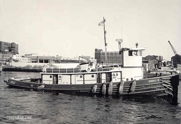
Built in 1958, by Jakobson Shipyard of Oyster Bay, New York (hull #383) as the tug Russell 10 for the Russell Brothers Towing Company of New York, New York. In 1961, the tug was acquired by the McAllister Brothers Towing Company of New York, New York, and in 1963 she was renamed Judith McAllister. In 1978, the tug was acquired by the Eklof Marine Corporation of Staten Island, New York, and renamed Celtic.
On November 17th, 1984 she was towing the 145 x 45 ft barge Cape Race via Long Island Sound from Bridgeport, Connecticut to Port Newark New Jersey. When the Celtic failed to answer radio calls and did not arrive on schedule the Coast Guard was contacted. The Coast Guard located the Celtic under an oil slick in 70 ft of water. She was 1.5 miles south of Sheffield Island. The position of the sunken tug is marked by buoy "WR-28" at Sheffield Island near Norwalk, Connecticut.
The bodies of her five crew members were retrieved by police divers. It is speculated that the tug was pulled down when the barge sank. The wreck remains intact and upright with barge still attached by her hawser. She was a single screw tug rated at 1,600 horsepower.
tugboatinformation.com


Questions or Inquiries?
Just want to say Hello? Sign the .