
Texas Tower TT-4 (1/2)
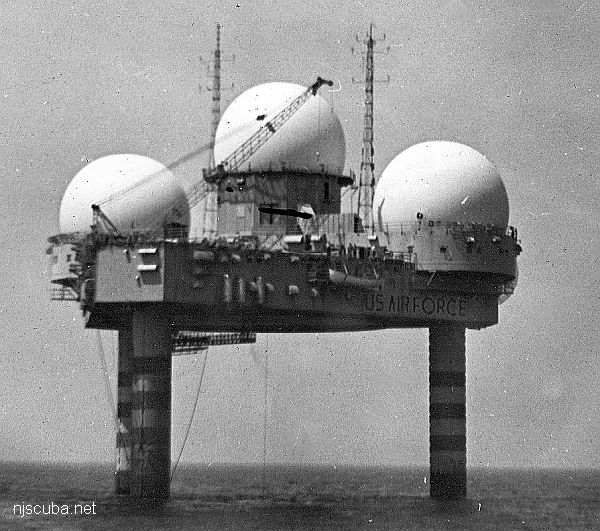
- Type:
- collapsed radar platform, USAF
- Built:
- 1955, Portland ME USA
- Specs:
- ( 67 ft above water) 6000 tons, 14 crew (minimum)
- Sunk:
- Sunday January 15, 1961
storm/structural failure/design deficiency - no survivors - GPS:
- 39°47'56.43" -72°40'08.00" (US Navy 2004)
- Depth:
- 180 ft, starts at 110 ft
The Texas Tower was named for its resemblance to an oil rig. It was one of three Air Force radar platforms placed off the eastern seaboard as part of the DEW ( Distant Early Warning ) Line. ( Towers #1 and #5 were never built. )
Unfortunately, this one was placed in deep water on an unstable mud bottom, whereas the other two were placed in shallow water on a solid, rocky bottom. From the beginning, there were structural and stability problems with Tower #4. It was decided to abandon it, but not before the sensitive radar equipment could be removed, to prevent it from falling into the hands of hovering Russian "trawlers."
As a precaution, the crew was reduced to a bare minimum. Just before the end, the platform's commander requested desperately that the tower be abandoned, but was ordered to stay on. The entire crew was lost when the tower collapsed in a hurricane. Only two bodies were even recovered.
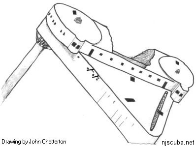
For a long time, the Texas Tower remained largely intact, propped up at an angle by its remaining leg. However, the latest reports are that over the winter of '99-'00, the tower collapsed even further, the remaining leg having pushed through the deck, leaving the highest point now at 120 ft instead of 65, and sinking lower. Anything interesting is below 140 ft - that's a mighty long boat ride to see a deep junk pile.
Strange that with all the government's resources, they couldn't construct a solid tower in 180 feet of water, when just a few years later the oil companies were building similar structures in hundreds or even thousands of feet of water. In the decades to follow, offshore drilling platforms that would dwarf the Texas Tower became commonplace.
Questions or Inquiries?
Just want to say Hello? Sign the .