Cape May Artificial Reef
Cape May Artificial Reef
8.5 Nautical Miles off Cape May, 5.34 sq miles
Depth: 50-75 ft [download]


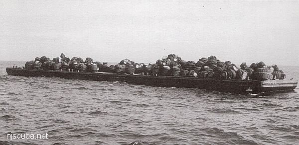
Cape May reef also contains large numbers of tire units and Army tanks (not shown) concentrated in the center area that appears here to be empty. This reef also received 50 redbird subways cars, which are not plotted. The Onondaga drifted slightly out of the reef boundaries, and the state does not list it, but it is there.
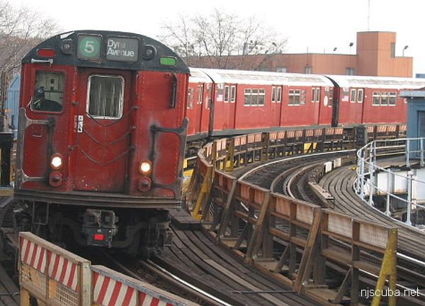
- Type:
- 250 "Redbird" subway cars - NYC Subway system - steel bodies / frames
- Built:
- 1959-1960 - American Car & Foundry - Model R26 # 7750-7859
1960-1961 - American Car & Foundry - Model R28 # 7860-7959
1962-1963 - St. Louis Car - Model R29 # 8570-8805
1962-1963 - St. Louis Car - Model R33 # 8806-9345
1963-1964 - St. Louis Car - Model R36 # 9346-9769 - Specs:
- ( 51 x 9 ft ) 15,000 to 18,000 pounds (body)
- Sunk:
- 50 cars - Cape May Reef on July 3, 2003
50 cars - Deepwater Reef on July 16, 2003
50 cars - Atlantic City Reef on July 25, 2003
50 cars - Garden State North Reef on Sept 3, 2003
50 cars - Shark River Reef on Oct 14, 2003
619 cars - Delaware Reef 11 from Aug 2001 to Nov 2003 - Sponsor:
- New York City Metropolitan Transportation Authority (MTA)
- anti-
Sponsor: - Environmental group Clean Ocean Action lobbied aggressively and almost successfully to prevent the use of these subway cars as artificial reefs in New Jersey, resulting in most of the cars going to other states.
- GPS:
- too many to list, and all gone anyway
- Depth:
- Depths vary by location between 80 ft and 130 ft.
More: Redbird Subway Cars ...
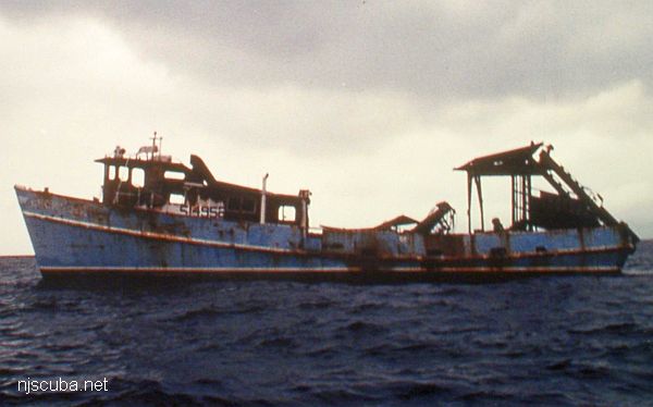
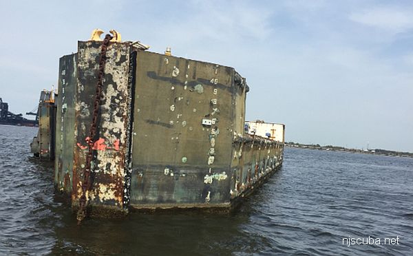
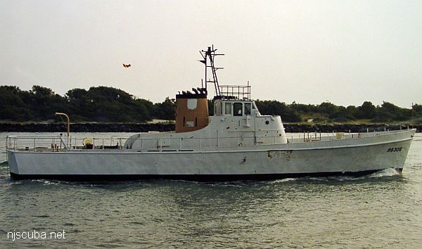
- Type:
- artificial reef, clam dredge, USA
- Built:
- 1968, Covacevich Shipyard, Biloxi MS, as Big Bill
- Specs:
- ( 85 x 23 ft )
- Sponsor:
- Cape May County Party & Charter Boat Association
- Sunk:
- Thursday July 25, 1991 - Cape May Artificial Reef
- GPS:
- 38°53.110' -74°01.030'
- Depth:
- 60 ft
More: Becky Lee ...
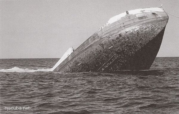
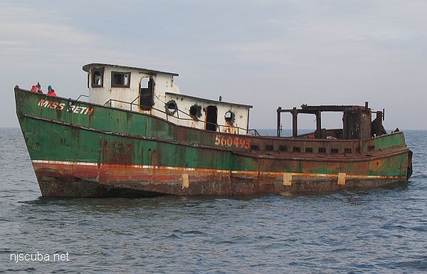
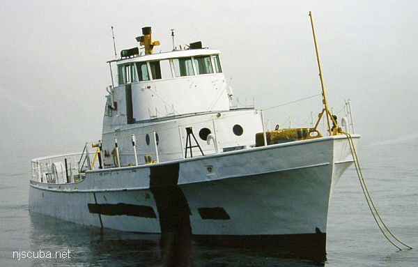
- Type:
- artificial reef, trawler, USA
- Specs:
- ( 135 x 32 ft )
- Built:
- 1945, American Bridge, Ambridge PA, as YF-879
- Sponsor:
- Cape May County Party & Charter Boat Association, Atlantic Cape Fisheries, Artificial Reef Association
- Sunk:
- Friday August 21, 1992 - Cape May Artificial Reef
- GPS:
- 38°53.118' -74°40.190'
- Depth:
- 70 ft
More: Sea Transporter YF-879 ...
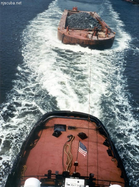
All manner of concrete, steel, and stone rubble from dredging, demolition projects, and other construction is used as artificial reef materials. This material is generally available at very low cost or free from construction companies who are more than happy to get rid of it. Transportation costs determine where this material is used by the Reef Program.
More: Rock & Rubble ...
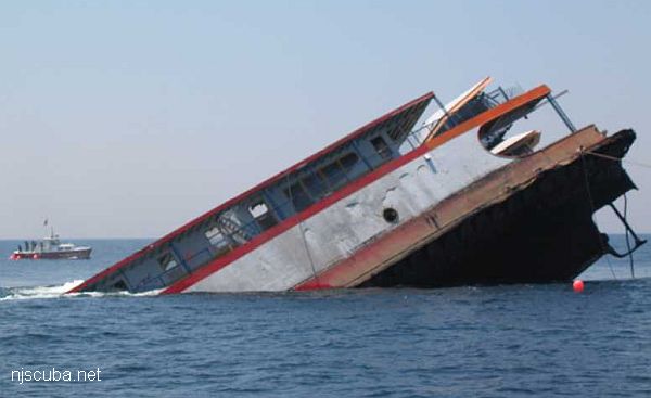
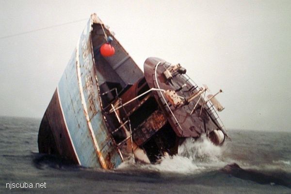
- Type:
- artificial reef, trawler, USA
- Built:
- 1974, Andy International, Brownsville TX, USA as Southport II
- Specs:
- ( 80 x 20 ft ) 146 gross tons
- Sunk:
- Tuesday January 29, 2008 - Cape May Artificial Reef
- GPS:
- 38°53.237' -74°40.545'
More: Miss Beth ...
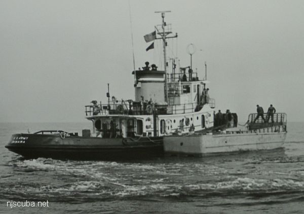
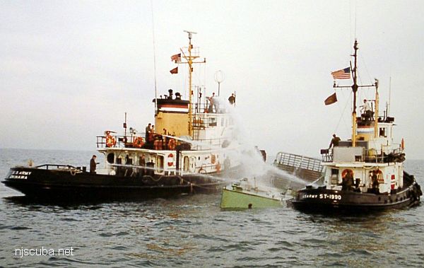
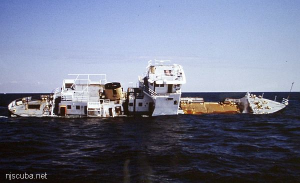
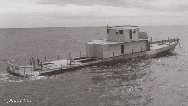
- Type:
- artificial reef, LCM-6 (Landing Craft-Mechanized, see "Captain Henry")
- Specs:
- ( 56 x 14 ft ) 64 tons
- Sponsor:
- Army Transportation Corps
- Sunk:
- Saturday November 14, 1987 - Cape May Artificial Reef
- GPS:
- 38°50.830' -74°42.510'
More: Peggy Diana LCM-6 ...