Warships
Warships
- USS Akron
- USS Algol
- USS Baldwin
- Bronx Queen
- Capt Henry
- Catamount
- USS Cherokee
- China Wreck
- HMS Culloden
- Great Isaac
- HMS Hussar
- Ida K
- Intrepid
- USS Jacob Jones
- Massachusetts
- R.C. Mohawk
- USS Moonstone
- USS Murphy
- New Jersey
- USS Ohio
- Olympia
- Peggy Diana
- USS Radford (main)
- USS San Diego
- SC-209
- SC-60
- USS Tarantula
- Texas Tower
- USS Turner
- ZPG-3W
A number of warships are sunk in New Jersey and New York waters:
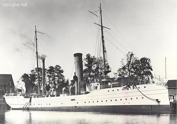
- Type:
- shipwreck, revenue cutter, U.S. Revenue Service, on loan to U.S. Navy
- Name:
- A tribe of Iroquoian Indians of the eastern New York area.
- Built:
- 1902, William R. Trigg, Richmond VA USA
- Specs:
- ( 206 x 32 ft ) 980 gross tons, 77 crew
- Sunk:
- Monday October 1, 1917
collision with tanker Vennachar - no casualties - GPS:
- 40°25.025' -73°45.158' (AWOIS 2010)
- Depth:
- 100 ft
More: R.C. Mohawk ...
- Type:
- shipwreck, submarine chaser, U.S. Navy
- Built:
- 1917, New York Naval Shipyard, New York NY USA
- Specs:
- ( 110 x 14 ft ) 85 tons
- Sunk:
- Tuesday October 1, 1918
collision with tanker Fred W. Waller - 2 casualties - Depth:
- 45 ft
More: Sub Chaser SC-60 ...
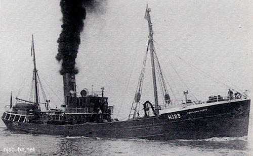
- Type:
- shipwreck, trawler, Royal Navy
- Name:
- Pentland Firth is the channel between the northern tip of Scotland and the Islands that form Scapa Flow, the great British naval base, and today one of the best wreck diving locales in the world.
- Built:
- 1934, England
- Specs:
- ( 164 x 27 ft ) 485 gross tons
- Sunk:
- Saturday September 19, 1942
collision with minesweeper trawler USS Chaffinch (400 tons) - ? casualties - GPS:
- 40°25.433' -73°52.204' (AWOIS 1991)
- Depth:
- 70 ft
More: HMS Pentland Firth ...
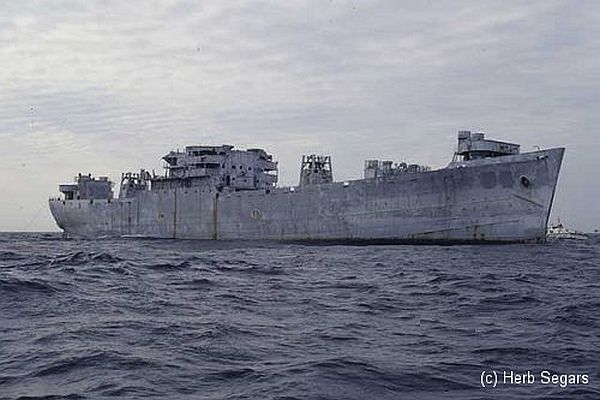
- Type:
- artificial reef, Andromeda class attack transport ( freighter ), U.S. Navy, also known as a "Victory Ship", although often incorrectly referred to as a Liberty Ship
- Name:
- One of a series of Navy transports named for stars;
Algol is a star in the constellation Perseus, also known as the Demon star. - Built:
- 1943, Moore Drydock, Oakland CA USA, as James Barnes
- Specs:
- ( 459 x 63 ft ) 13910 displacement tons, 429 crew *
* this figure almost certainly includes embarked Marines - Sponsor:
- Federal Aid in Sportfish Restoration
- Sunk:
- Thursday November 22, 1991 - Sea Girt Artificial Reef
- GPS:
- 40°06.545' -73°41.450'
- Depth:
- 145 ft +, starts at 70 ft, main deck at 110 ft
More: USS Algol AKA-54 ...
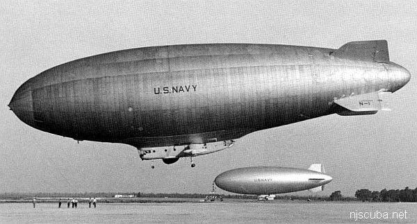
- Type:
- shipwreck, blimp, U.S. Navy
- Built:
- 1958, Akron OH USA
- Specs:
- ( 403 x 85 ft ) 40 tons, 21 crew
- Sunk:
- Wednesday July 6, 1960
unknown cause - 18 casualties - Depth:
- 60 ft
More: ZPG-3W Reliance ...
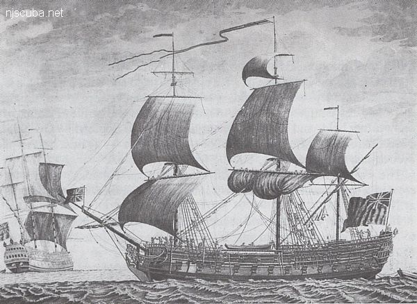
- Type:
- shipwreck, frigate, British Royal Navy
- Name:
- The Battle of Culloden, where in 1745 the English army massacred the last of the Scottish resistance ( and much of the civilian population ), completing the English conquest of Scotland.
- Built:
- 1776, England
- Specs:
- ( 170 x 47 ft ) 1658 gross tons, 650 crew
- Sunk:
- Monday January 24, 1781
ran aground in storm - no casualties - Depth:
- 20 ft
More: HMS Culloden ...