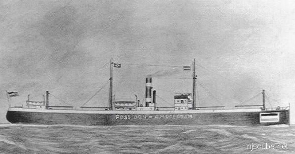
AWOIS Database (2/2)
The Office of Coast Survey's Automated Wreck and Obstruction Information System (AWOIS) contained information on over 10,000 submerged wrecks and obstructions in the coastal waters of the United States. Information included latitude and longitude of each feature along with brief historic and descriptive details. The AWOIS system has been discontinued, the replacement is here.
More: AWOIS Database ...
FE312SS/88 -- OPR-C121-WH-88; WHILE SEARCHING FOR AWOIS ITEM 1634, TWO SIDE-SCAN SONAR CONTACTS WERE LOCATED AND IDENTIFIED AS WRECKAGE (ALSO REFERENCE ITEM 7508); AN OBSTRUCTION (SSS CONTACT NO. 379.6S) WAS FOUND; DIVER LEAST DEPTH OF 36 FT. IN PRESENT SURVEY DEPTHS OF 38 FT.; REMAINS OF A PORTION OF A KEEL OF A METAL HULLED VESSEL; VESSEL WAS LYING INVERTED WITH THE KEEL EXPOSED; PORTION OF MIDSECTION OF VESSEL WAS VISIBLE; ENTIRE STRUCTURE WAS COATED WITH ANTI-FOULING PAINT; 45 FT. WIDE AT THE BEAM, 37 FT. AT THE NORTHERN END AND 18 FT. LONG; SOUTHERN END OF SITE WAS BENT AND TWISTED; HULL STOOD APPROXIMATELY 3 FT. OFF THE BOTTOM AT THE NORTHERN END, AND A SAND SCOUR AT THE SOUTHERN END EXPOSED APPROXIMATELY 6-8 FT. OF THE WRECK (3-4 FT. BELOW THE SURROUNDING BOTTOM). (ENTERED MSM 10/89)
More: u12 - AWOIS 7509 ...
H10224/86 -- OPR-C121-WH-86; WHILE INVESTIGATING ITEM 751, AN AREA WITH NUMEROUS SIDE-SCAN SONAR CONTACT WAS FOUND AND DEVELOPED USING SIDE-SCAN AND ECHO SOUNDER; DIVER INVESTIGATION DETERMINED LIMITS OF SITE, NATURE OF WRECKAGE, AND LOCATION OF THE LEAST DEPTH; SITE WAS ORIENTED NORTHEAST-SOUTHWEST; CONSISTS MOSTLY OF SHIPYARD DEBRIS IN THE FORM OF HEAT EXCHANGERS, BUCKLED DECK PLATING, TWISTED ANGLE IRON, WOODEN RIBS, AND PIPING OF VARIOUS LENGTHS AND SIZES; THE NORTHEAST END OF THE SITE CONSISTED OF A BARGE LYING IN A NORTHWEST-SOUTHEAST DIRECTION WITH THE BOW OF THE BARGE DEFINING THE SOUTHEAST WALL OF THE SITE; THE NORTHWEST END OF THE BARGE, THE STERN, WAS COVERED WITH METAL DEBRIS, HAWSER LINES, AND TRAWLER NETTING; DIVERS CONCLUDED THAT THIS SITE IS THE WRECK OF A BARGE THAT WAS FILLED WITH SHIPYARD SCRAP IRON AND DEBRIS; PNEUMATIC DEPTH GAUGE LEAST DEPTH OF 50 FT. (ENTERED MSD 4/91)
More: u13 - AWOIS 7932 ...
H10224/86-88 -- OPR-C121-WH; SIDE-SCAN SONAR CONTACT. DIVERS DESCRIBE A WRECK SITE 250' X 50' CONTAINING THE REMAINS OF WHAT APPEARED TO BE A WOODEN VESSEL (DECK MACHINERY, 3-FOOT DIA. METAL CYLINDER, LARGE TIMBERS REINFORCED WITH METAL PLATES). LD (PNEUMO) OF 53 FEET. (ENT 5/30/96, SJV)
More: u14 - AWOIS 9768 ...