Manasquan Inlet Artificial Reef
2 miles off Manasquan Inlet
Depth: 67-74 ft [download]
The Susan Rose is a secret reef, sunk with no public notice or announcement. It will no doubt be used for another completely scientific prolonged "study of successional development and monitoring" like the Carrabassett since 2024 New England Coast since 2023. Here is the NJDEP contact form if you would like to inquire about the progress of these studies:
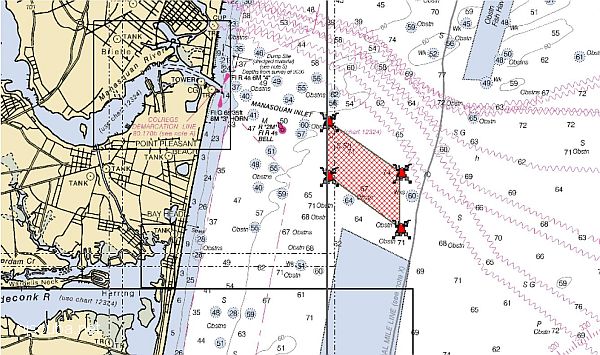
The Manasquan Inlet Reef site is located 1.7 nautical miles southeast of the inlet, which is just north of Ocean County’s Point Pleasant Beach. When fully developed, it will occupy nearly one square mile of seafloor in water from 67 feet to 74 feet deep. The reef is part of a compromise reached in 2015 that settled fishing gear use and access to artificial reefs between recreational and commercial fishermen and restored federal funding to New Jersey’s artificial reef program.
Putting a fishing reef directly in the approaches of one of the busiest inlets on the East Coast doesn't seem like a great idea to me, but I guess I am wrong about that, because there it is. I think my "Pinta Reef" would have been a much better idea.
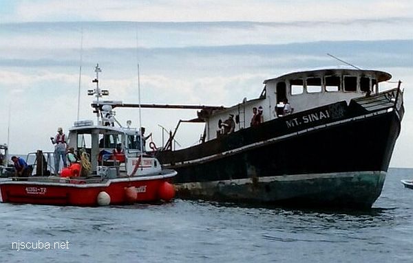
- Type:
- artificial reef, trawler
- Built:
- 1979, Gulf Coast Marine Builders, Bayou La Batre AL as Scott & Mike
- Specs:
- ( 87 ft ) 135 gross tons
- Sunk:
- Tuesday June 27, 2017 - Manasquan Artificial Reef
- GPS:
- 40°04.980' -73°59.410'
- Depth:
- 75 ft
More: Mount Sinai ...
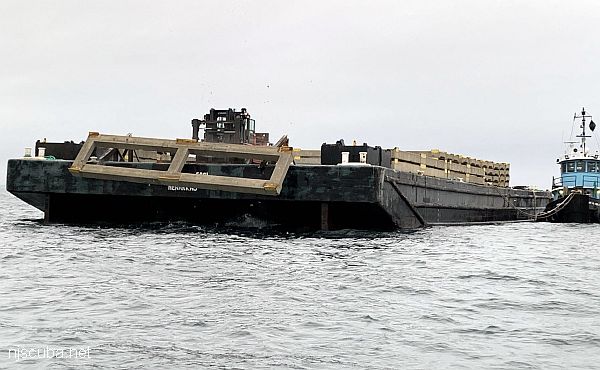
This new feature inside the Manasquan Inlet reef site will be called the Maher Terminals Reef in recognition of the donated material by Maher Terminals, located in Port Elizabeth, NJ. The material consisted of 151 concrete forms, measuring 40 feet x 8 feet x 1.5 feet each. The forms, once used for shipping container inspections, were no longer needed and were slated for demolition and disposal. Center point coordinates are 40° 04.617' N and 073° 59.040' W.
More: concrete ...
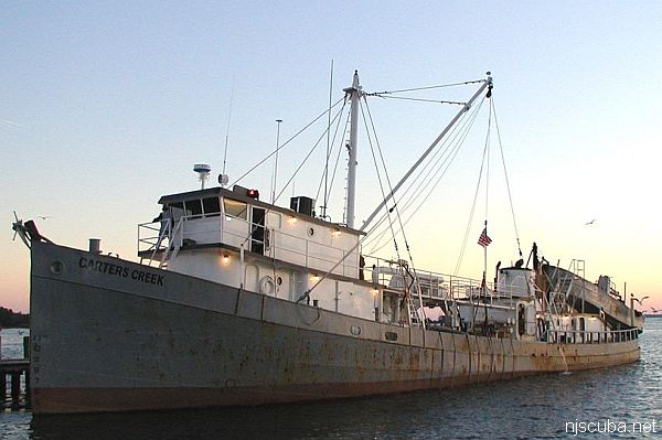
- Type:
- artificial reef, trawler, purse seiner
- Built:
- 1948, RTC Shipbuilding, Camden NJ, USA, as Absecon
- Specs:
- ( 130x25 ft ) 198 gross tons (as built)
- Sunk:
- Wednesday May 19, 2021 - Manasquan Artificial Reef
- GPS:
- 40°05.010' -73°59.632'
- Depth:
- 75 ft
More: Carter's Creek ...
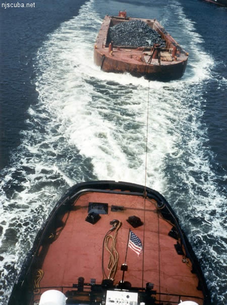
All manner of concrete, steel, and stone rubble from dredging, demolition projects, and other construction is used as artificial reef materials. This material is generally available at very low cost or free from construction companies who are more than happy to get rid of it. Transportation costs determine where this material is used by the Reef Program.
More: Rock & Rubble ...
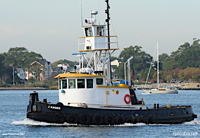
- Type:
- artificial reef, tugboat
- Built:
- 1975, Diamond Manufacturing, Savannah GA, USA, as Capt. Leary
- Specs:
- ( 53 x 18 ft ) 55 tons
- Sunk:
- Thursday Jan 14, 2021 - Manasquan Artificial Reef
- GPS:
- 40°04.784' -73°59.420'
- Depth:
- 75 ft
More: Ranger ...
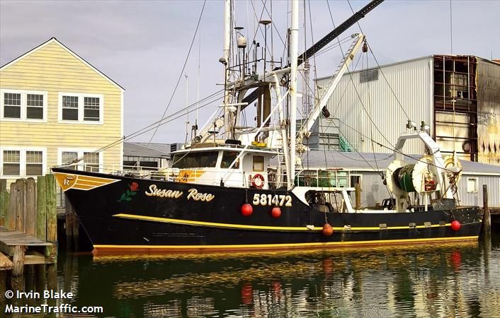
- Type:
- artificial reef, trawler
- Built:
- 1977, Steiner Shipyard, Bayou La Batre AL as Margaret Rose
- Specs:
- ( 77 ft ) 142 gross tons
- Sunk:
- Thursday Feb 13, 2025 - Manasquan Artificial Reef
- GPS:
- UNPUBLISHED
- Depth:
- 75 ft
The Susan Rose is a secret reef, sunk with no public notice or announcement. It will no doubt be used for another "period of successional development and monitoring" like the Carrabassett since 2024 and the New England Coast since 2023. Here is the NJDEP contact form if you would like to inquire about the progress of these studies:
More: Susan Rose ...
Artificial Reef Charts, Charts, Dive Sites, Manasquan Dive Sites, New Jersey Artificial Reef Charts, New Jersey Dive Sites,
3.6 Nautical Miles off Sea Girt
Depth: 60-75 ft [download]
More: Sea Girt Artificial Reef ...
2.0 Nautical Miles off Mantoloking
Depth: 65-80 ft [download]
More: Axel Carlson Artificial Reef ...
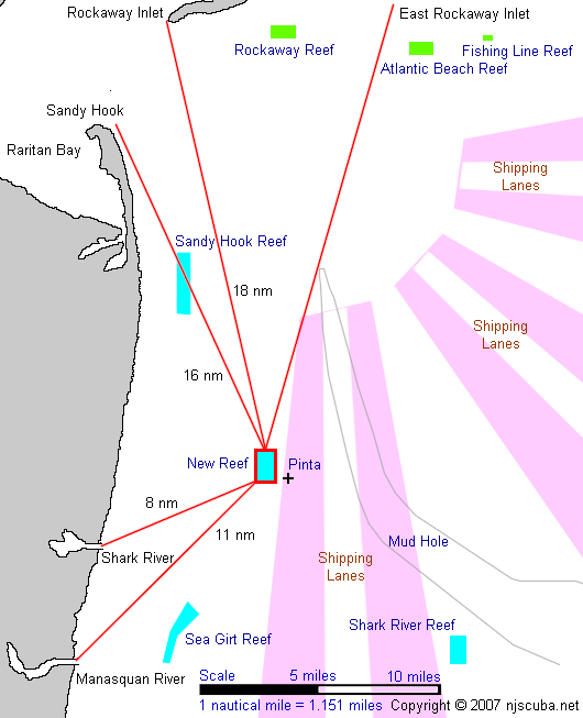
This is my modest proposal for a new reef site that could be shared between New York And New Jersey. This site has a lot of advantages:
More: Pinta Reef ...
Questions or Inquiries?
Just want to say Hello? Sign the .