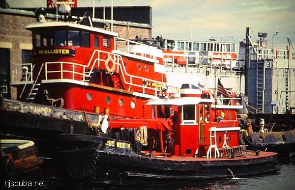
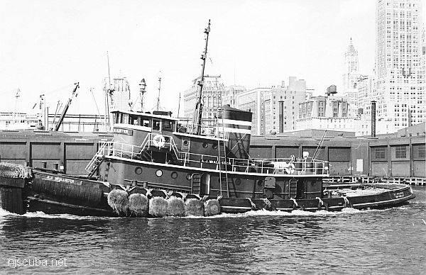
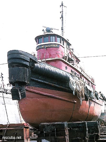
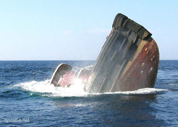
AJ McAllister YNT-12
- Type:
- artificial reef, tugboat
- Built:
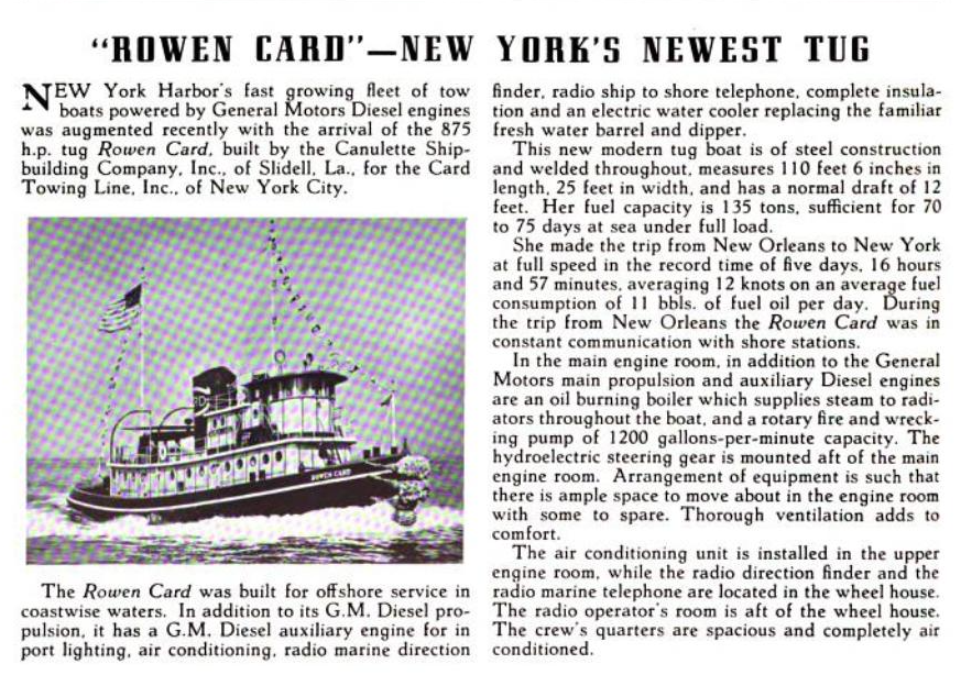
- 1939, Southern Shipbuilding, Slidell LA as Rowen Card
- Specs:
- ( 106 x 26 ft ) 263 tons
- Sponsor:
- Ann E Clark Foundation
- Sunk:
- Thursday Sept 25, 2003 - Deepwater Artificial Reef
- GPS:
- 39°58.004' -74°10.721'
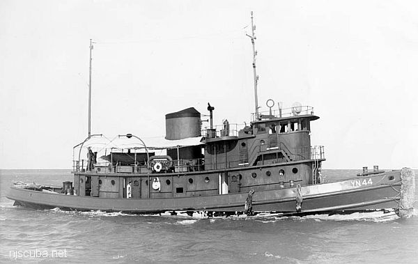
Built in 1939, by Canulette Shipbuilding Company of Slidell, Louisiana (hull #983) as the Rowen Card for the Card Towing Company of Norfolk, Virginia. In 1940, she was acquired by the United States Navy and designated YN-44 Tamaha. Later redesignated as the YNT-12. In 1947, the tug was returned to the Card Towing Company of Norfolk, Virginia, and renamed Rowen Card. In 1947, she was acquired by the McAllister Brothers Towing Company of New York, New York, and renamed A.J. McAllister. Originally powered by a single, Winton Diesel engine. The tug was repowered in 1960, she was a single screw tug, rated at 1,800 horsepower.
tugboatinformation.com
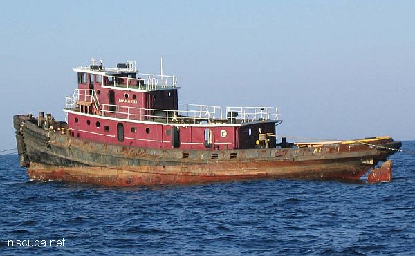
The A.J. McAllister is right on the edge of the permitted reef area, and part of it probably sticks out. The NJ Artificial Reef Program does not show it in their official lists, along with the Diver's Abyss, which is slightly outside the reef.
Deepwater Artificial Reef
Artificial Reef Sites, Artificial Reefs, Deepwater Artificial Reef, McAllister Towing & Transportation, Military Reefs, New Jersey Artificial Reef Sites, New Jersey Artificial Reefs, Tugboats, Unlisted Reefs,
Deepwater Artificial Reef
23.6 Nautical Miles off Ocean City, 1.03 sq miles
Depth: 90-125 ft [download]
More: Deepwater Artificial Reef ...
Cape May Chart
- 44009 Weather Buoy
- Absecon Inlet
- USS Akron
- Alex Gibson
- Alexander
- Almirante
- American
- Astra
- Atlantus
- Azua
- Dorothy B Barrett
- Brigantine Beach Wreck
- USS Blenny
- boiler wreck
- Brian C
- Brigantine Inlet
- Brigantine Buoy Wreck
- Charles Morand
- Cape May Inlet
- Cassandra
- Cayru
- Champion
- USS Cherokee
- China Wreck
- City of Athens
- City of Georgetown
- Clermont
- Corson’s Inlet
- William B Diggs
- dredge
- Admiral DuPont
- Elizabeth Warren
- Evening Star
- car float
- Florida
- Galimore's Cayru
- Gory Wreck
- Great Egg Inlet
- Gypsum Prince
- Hereford Inlet
- Hornet
- Hvoslef
- India Arrow
- Indian River Inlet
- USS Jacob Jones
- John Marvin
- China Junk Wreck
- Kennebec
- King Cobra
- Lemuel Burrows
- Lake Frampton
- Lady Mary
- Linda Snow II
- Marine Electric
- Miraflores
- Misty Blue
- Mohawk
- Montgomery
- USS Moonstone
- EF Moran
- Northern Pacific
- Nuphar
- Oklahoma
- Patrice McAllister
- Pet Wreck
- Poseidon
- Ranald
- RJ Walker
- Southern Lillian
- USS S-5
- Salem
- Salem
- San Jose
- Sea Girt
- Shookus
- Sindia
- Slabs
- General Slocum
- Southern Sword
- Townsend's Inlet
- Varanger
- Wayne
- Wily Fox
- YP-387
More: Cape May Dive Sites Chart ...
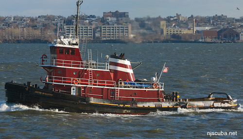
McAllister Towing is one of the oldest and largest marine towing and transportation companies in the United States. They operate a fleet of more than seventy tugboats and twelve barges along the East Coast from Portland, Maine to San Juan, Puerto Rico.
More: McAllister Towing & Transportation ...

Questions or Inquiries?
Just want to say Hello? Sign the .