Captain Bill
- Type:
- artificial reef, tugboat, McAllister Towing (Boston)
- Built:
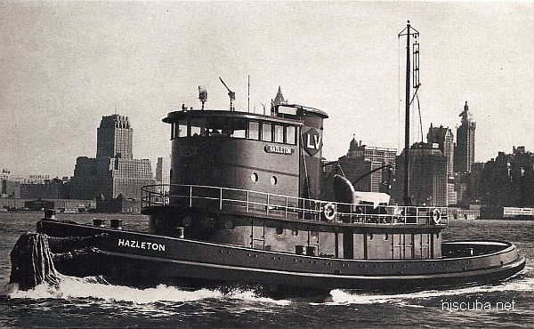
- 1950, Jakobson Shipyard, Oyster Bay, NY as Hazleton
- Specs:
- ( 110 x 27 ft ) 199 gross tons
- Sponsor:
- Herb & Veronica Segars
- Sunk:
- Wednesday November 10, 2004 - Axel Carlson Artificial Reef
- GPS:
- 40°03.104' -73°59.283'
- Depth:
- 75 ft
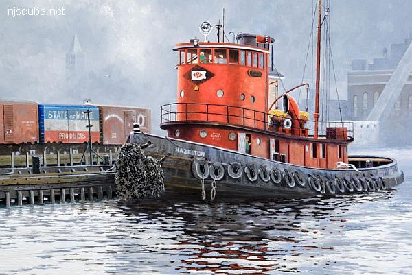
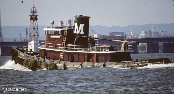
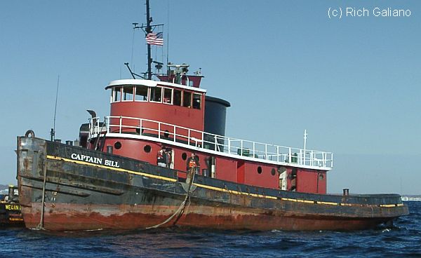
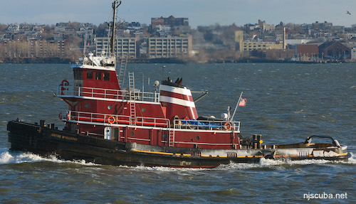
Built in 1950, by Jakobson Shipyard Incorporated of Oyster Bay, New York (hull #328) as the Hazleton for the Lehigh Valley Railroad Company of Bethlehem, Pennsylvania. In 1963, she was acquired by the Moran Towing Company of New York, New York, where she was renamed as the Marie Moran.
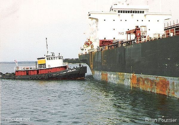
In 1984, the tug was acquired by the R.J. Casho Marine Towing Company of Wilmington, Delaware, where she was renamed as the Marie Casho. In 1986, she was acquired by Captain Arthur Fournier of the Penobscot Bay Towing Company of Belfast, Maine, where the tug was renamed as the Captain Bill.
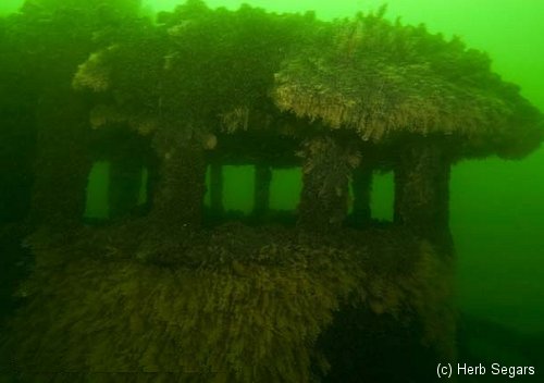
In 2004, the tug was reefed off of Bayhead, New Jersey as part of an artificial reef program, where the tug was renamed as the Veronica M. Named for the wife of a longtime local diver and underwater photographer Herb Segars.
Powered by a single Cleveland 16-278A diesel engine, 1,600 horsepower.
Paul Strubeck, Captain Brian Fournier
tugboatinformation.com
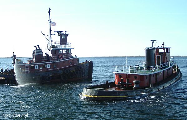
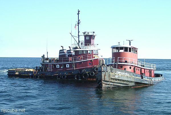
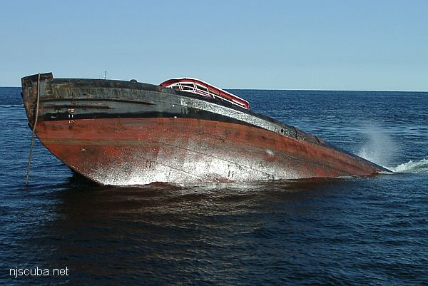
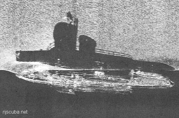
The sinking of the "Veronica M" took 4-1/2 hours and 40 seconds. The block of the 1750 hp diesel engine is still inside, as well as the 120" bronze propeller. This tug is one of the largest ever sunk as a reef in New Jersey. Compared to others in the area, it is massive.

Artificial Reef Sites, Artificial Reefs, Axel Carlson Artificial Reef, McAllister Towing & Transportation, New Jersey Artificial Reef Sites, New Jersey Artificial Reefs, Tugboats,
Axel Carlson Artificial Reef
- "small old wreck"
- Austin
- Barbara Ann
- Bay King
- big barge
- Brooklyn
- Manasquan Inlet Buoy
- Captain Bill
- Carrabassett
- Caterina.D
- Colleen
- crab barge
- Delaware
- Ed Schmidiger
- Glory Wreck
- Hail Mary
- Harbor Charlie
- Hillman III
- Jim Lynch
- Manasquan Inlet
- McGinty
- Megan Sue
- Middle Barge
- MRMTC 8
- MRMTC 9
- OWD III
- Patrick McHugh
- Riggy
- Rump
- Shark River Inlet
- Snug Harbor
- Swensen
2.0 Nautical Miles off Mantoloking, 5.19 sq miles
Depth: 65-80 ft [download]
More: Axel Carlson Artificial Reef ...
Manasquan Chart
- Barge #10
- 120 Wreck
- 3 Sisters
- Ambrose Buoy
- A Street - Shark River
- Across
- Adele
- Ajace
- Alex Mac
- Allenhurst Jetty
- Anastasia
- Antioch
- Arnoff
- Arundo
- Asfalto
- Aurora
- Ayuruoca
- BA Wreck
- Shark River - Back Bay
- Balaena
- Bald Eagle
- Barnegat Inlet
- BD1738
- USS Benson
- Beth Dee Bob
- Blue Boy
- Bonanza
- Brick barge
- Bronx Queen
- Brunette
- Cecilia M Dunlap
- Cornelius Grinnell
- Catherine Jackson
- Chauncy Jerome
- Caddo
- Cadet
- Capt Smitty
- Catamount
- Charlemagne Tower
- Chaparra
- Chesapeake
- Choapa
- clam boat
- Continent
- crane barge
- Creole
- Daghestan
- Delaware
- drydock
- Dryland
- dump
- Duncan
- Edmund Phinney
- Elberon Rocks
- Emerald / USS Hibiscus
- Eureka
- Francis A Perkins
- William R Farrell
- FF Clain
- Finance
- Fort Victoria
- Gassoon
- German
- Lady Gertrude
- GL78
- Glen II
- Glory Wreck
- I.P. Goulandris
- Granite Wreck
- Great Isaac
- Gulftrade (stern)
- Gulftrade (bow)
- Gypsy
- Horseshoe Cove
- Alexander Hamilton
- Hankins (Big)
- Hankins (Offshore)
- Hankins 3
- Happy Days
- Cornelius Hargraves
- Harry Rush
- Harvey's Schooner
- Thomas Hebert
- Ida K
- Immaculata
- Inshore barge/tug
- Irene/Truro
- Irma C
- John Minturn
- Jack I
- Joan La Rie III
- Klondike Rocks
- Lizzie H. Brayton
- Lana Carol
- Larsen
- Lavallette Wreck
- Leon Walter
- Lillian
- Lizzie D
- Long Branch locomotives
- Logwood
- H.W. Long
- Macedonia
- Mahogany
- Malta
- Manasquan Inlet
- Marion
- Maurice Tracy
- Mediator
- Meta
- Middle Barge
- Mistletoe
- R.C. Mohawk
- Mohawk
- Manasquan Wreck
- Nautilus
- Navesink River
- Northeast Sailor
- New Reef
- New Deal
- New Era
- NW Barges
- Olsen
- HMS Pentland Firth
- Park City
- Peerless
- Persephone
- Long Branch Pier Rubble
- Pinta
- Pliny
- Plymouth
- Pocopson
- Remedios Pascual
- Ruth Shaw
- Ramos
- Ranger
- Reliable
- Relief Lightship
- Rickseckers
- Ridge Schooner
- Riggy
- Rjukan
- Rockaway Belle
- Roy's barge
- RP Resor
- Manasquan River Railroad Bridge
- Rudder Wreck - Pocono
- Rump
- Rusland / Adonis
- Scotland Buoy
- San Saba
- Sandy Hook Pilot Boat
- SC-60
- Sea Girt Inlet
- Sea Girt Wreck
- Sea Hag
- Seaside Crane Barge
- Shark River Inlet
- Shrewsbury Rocks
- Simala
- Spring Lake Sailor
- Steel Wreck
- Stolt Dagali
- Sumner
- Southwest Mohawk
- Sylvanus
- Tampa III
- Thurmond
- Tolten
- Train Wheel
- Troop Carrier
- USS Turner
- AWOIS 8087
- AWOIS 8097
- u11
- AWOIS 7509
- AWOIS 7932
- AWOIS 9768
- AWOIS 12966/11422
- AWOIS 1609
- AWOIS 8084
- AWOIS 7940
- AWOIS 7938
- AWOIS 8076
- AWOIS 4600
- AWOIS 8075
- Valerie E
- Vega
- Vivian
- Vizcaya
- Warrior
- Western World
- Edward W Winslow
- Edward W Winslow
- Yankee (G+D)
- Yellow Flag
- ZPG-3W
More: Manasquan Dive Sites Chart ...
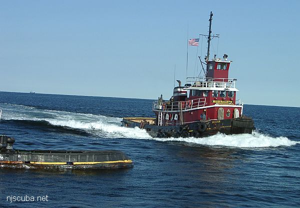
McAllister Towing is one of the oldest and largest marine towing and transportation companies in the United States. They operate a fleet of more than seventy tugboats and twelve barges along the East Coast from Portland, Maine to San Juan, Puerto Rico.
More: McAllister Towing & Transportation ...
Questions or Inquiries?
Just want to say Hello? Sign the .