Lost At Sea (1/9)
Lost at Sea
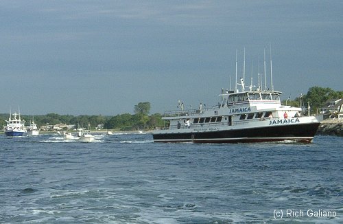
In January 1999, four clam boats were lost in separate incidents in the span of less than three weeks. First, on January 6, the Beth Dee Bob sank in rough weather with all hands. Two days later, the Cape Fear sank under similar circumstances. On January 18, the Adriatic went down with all hands, one day after the Ellie B ran up on the rocks at Manasquan Inlet. In total, 10 lives were lost, sparking a major Coast Guard investigation into safety practices on commercial fishing vessels.
Point Pleasant NJ
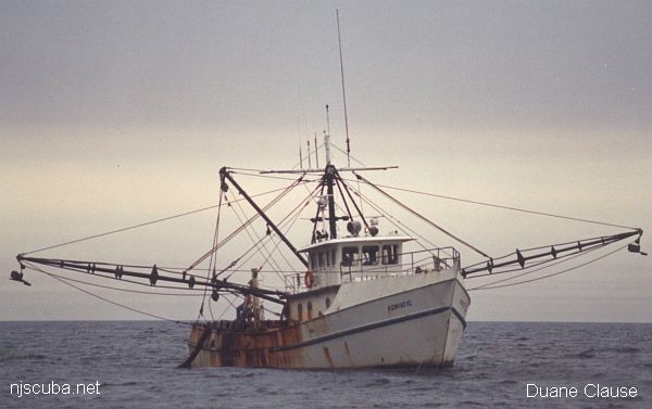
"This picture was taken several years ago by my wife, Debbie. We were searching for the Adriatic's lost clam dredge that day. Later, after the sinking, my group of divers was the first to dive on and identify her. I used this picture at the dive site to set the dive plan and objectives."
- Capt. Duane Clause, Porthole II
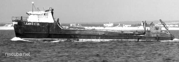
- Type:
- shipwreck, clam dredge, USA
- Built:
- 1977, Master Marine, Bayou La Bâtre AL USA
- Specs:
- ( 74 ft ) 134 gross tons, 4 crew
- Sunk:
- Monday January 18, 1999
foundered in rough seas - no survivors - Depth:
- 65 ft
More: Adriatic ...
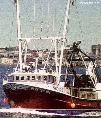
- Type:
- shipwreck, clam dredge, USA
- Built:
- 1990, Bock Marine, Beaufort NC USA
- Specs:
- ( 84 ft ) 96 tons, 4 crew
- Sunk:
- Wednesday January 6, 1999
foundered in rough seas - no survivors - Depth:
- 120 ft
More: Beth Dee Bob ...
- Type:
- artificial reef, clam dredge
- Built:
- 1983, James K Walker Marine, Moss Point MS USA
- Specs:
- ( 112x24 ft ) 188 gross tons
- Sunk:
- Wednesday March 8, 2000 - Moriches Artificial Reef
- Depth:
- 75 ft
- GPS:
- 40°43.505' -72°46.386'
More: Cape Fear ...
- Type:
- shipwreck, clam dredge, USA
- Built:
- 1978, Ancient City Boat Yard, St. Augustine, FL USA
- Specs:
- ( 68 ft ) 3 crew
- Sunk:
- January 17, 1999; ran up on jetty
no casualties - Depth:
- 15 ft
More: Ellie B ...
A dredge is a vessel designed to remove sediment from the bottom, generally for the purpose of widening and deepening ship channels. However, the term is often applied to a specialized type of trawler. A clam dredge is a special type of trawler that takes clams from the sand. The device that actually does this is also called a dredge. Resembling a large steel cage, it is dragged across the sandy bottom, and rakes out the shellfish, along with rocks, debris, some bottom fish and lobsters, the occasional lost anchor, and anything else that is in its path.
More: Clam Dredges ...
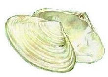
The inshore wrecks are sometimes surrounded by the empty shells of Surf Clams Spisula solidissima, right, to 7" across. Large numbers of the white shells also wash up on beaches. Surf Clams are found subtidally down to 100 feet ( which makes you wonder why they are called surf clams. )
Tiny angel wing-shaped Coquina clams Donax variabilis less than 1 inch long do live in the surf, on wave-tossed sandy beaches.
More: Clams ...