Welcome to NJScuba.net, a website dedicated to exploring the New Jersey / New York region underwater -- "Wreck Valley". Here you will find information on dive sites, marine biology, artifacts and activities, gear and training, and many other subjects.
N.J. Shore inlet to be surveyed after large sandbar forms
By Nicolas Fernandes NJ Advance Media for NJ.com Aug. 17, 2022
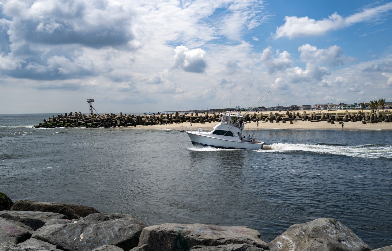
Sand piling up in Manasquan Inlet
Linda Anne, a 38-foot sportfishing boat based in Manasquan, heads outbound from Manasquan Inlet on Thursday, Aug. 11, 2022, in Manasquan. Sand has piled up along the south jetty, which some say has created hazardous navigational conditions as well as a new beach inside the inlet. Andrew Mills | NJ Advance Media for NJ.com
The Army Corps of Engineers will visit the Manasquan Inlet next week to survey a large sandbar that has formed in the waterway, U.S. Rep. Chris Smith, R-4th Dist., said Wednesday.
Sands at the inlet have shifted before, but the low-tide sandbar is larger than anything seen there before, the congressman said.
"We are gravely concerned that it will pose a serious hazard to navigation," Smith said.
I finished the Dives Sites section of the website, the biggest and most complex part. I also finished the central 'hub' of the site and made some inroads in the Artificial Reefs and Biology sections. I'm also fixing things as I go, like broken weather forecasts.
And none too soon - the old site has become rather balky since I stopped paying attention to it several years ago. For one thing, it will not run on the latest version of PHP. Rather than figure that out, I'll put my efforts into this. It just took five minutes to load a page.
I also added Google Earth integration, which will let you zoom in on land-based sites. Not much point in setting it up at sea though, my 20-year-old wreck charts are still better than anything.
This site is now running on WordPress, with everything stored in a database. That gives a lot of flexibility. I don't really care for WordPress sites, they're usually ugly slabs with no structure. But I've buried WordPress so deep in here that you can't even tell it is there.
I finished the Artificial Reefs section of the website, probably the second-largest piece after Dive Sites. These two are also the most complicated sections, since they involve geography and spatial relations. Again, no more clickable charts. That would be a huge job, and I would have to get awfully bored to want to tackle it. WordPress is doing a very nice job of handling all the relationships between pages and subjects.
Using WordPress taxonomies, a site no longer needs to 'belong' to a particular chart, it can belong to several at once. That was something that had to be hand-coded before. There's an old programming adage: "All problems in computer science can be solved by another level of indirection." Look up that quote if you are interested.
WordPress tells me that Artificial Reefs worked out to 235 pages, while Dive Sites is 425.
Finished the Artifacts section, which turned out to be more work than expected. Although the page count is only 69, many of the pages are long and complex, and some of them even have calculators on them. Needless to say, WordPress didn't like any of this, and balked at almost everything. I've been making use of the 'html' block rather than try to do complex things in WordPress' ham-fisted editor.
Finished the Biology section, which ended up being 261 pages. This easily surpasses Artificial Reefs to be the second-largest section after Dive Sites.
Waded into the last section - Dive Gear. Did a lot of long complex pages, and even got the decompression program working by a couple of quick-and-dirty hacks. I think I will make a plugin of it.
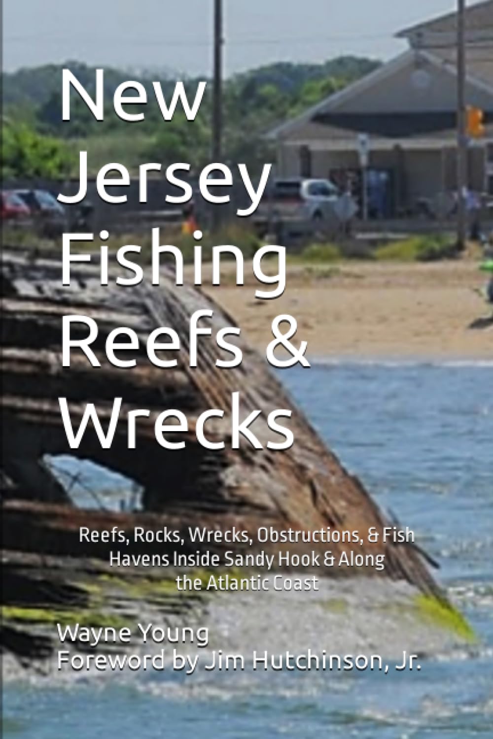
I just received my signed copy of this new book, and I must say I am very impressed. It has over 400 pages of information, charts, images, and GPS numbers. This is a must-have for any New Jersey wreck diver.
This website has a link checker, and it just informed me that the OMS link was bad. Sure enough, the website is gone. But it looks like DUI has taken over OMS - the full line of OMS stuff is in the 'OMS' section of DUI's site. So it's probably a good thing, especially in this economic environment. DUI will be around for a long time - they make most if not all of the military's drysuits. Now they have a full line of tech gear; as I recall, I was never too impressed with their own BC designs. Just checked on Dive Rite - they're still there.
Since starting the site, I used charts with white water and gray land, and when I re-built all the charts in OpenLayers, it was easy enough to duplicate that. But I noticed that when you print a page, the gray land disappears. I have never found any documentation on the OpenLayers json map specifications, but I picked-apart some examples and eventually hacked-together a solution where the land is green and it does print. So hooray for that.