Lake Hydra, formerly Dutch Springs, has re-opened. However, it is strictly for certification classes, and all the land-side facilities are gone. Still, much better than nothing!
Uncategorized (2/5)
- Home ...
- Dive Sites ...
- Artificial Reefs ...
- Marine Biology ...
- Artifacts ...
- Gear & Training ...
- Blog ...
- Cozumel ...

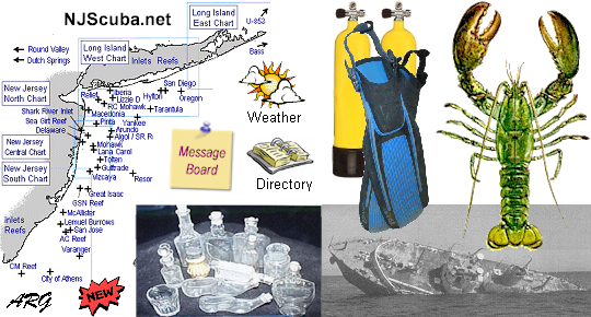
Welcome to NJScuba.net, a website dedicated to exploring the New Jersey / New York region underwater -- "Wreck Valley". Here you will find information on dive sites, marine biology, artifacts and activities, gear and training, and many other subjects.
More: Home ...
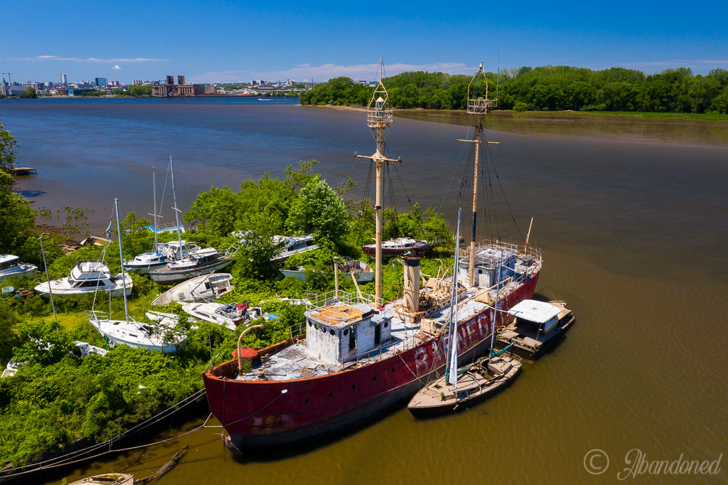
Above is the lightship Barnegat, LV-79, 1904, stuck in the mud at the defunct Pyne Poynt marina in Camden. The site and the vessel were acquired by Camden County in 2023. Soon after, the county announced the intention of restoring the vessel, but since then nothing has been done, and I doubt anything ever will be. The vessel is in pretty bad shape, stripped of anything of worth, and Camden has more pressing needs for its budget dollars.
More: Future Reef ...
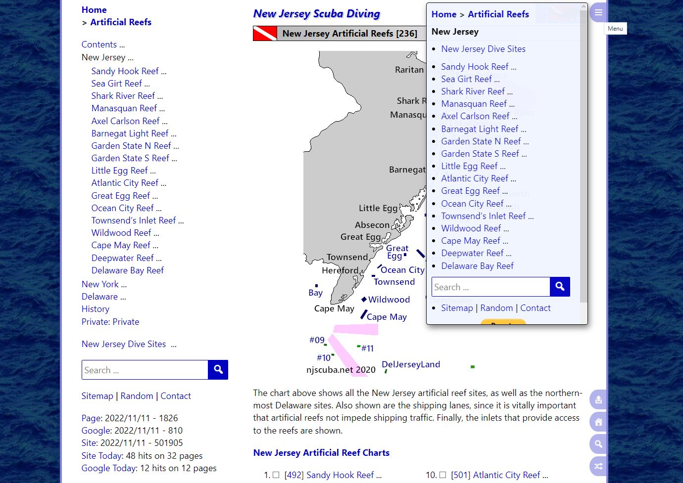
I've been hacking up a storm, and I've made some major improvements to the mobile navigation menus, as you can see in the very meta screenshot above. In fact, it's now almost as good on a cellphone as on a big desktop computer. This website has well over a thousand pages, which calls for excellent navigation features if you're ever going to find anything. That's a real problem on a tiny cellphone screen - where do you put it?
More: Hacking ...

I've been thinking of doing something like this for a long time. It would be much easier to maintain, but it would be a huge task to move 20 years of content over to the new platform.
After a few hours of hacking, I can't believe I got WordPress to largely replicate the look and feel of the old hand-made site. I always thought the old site was beautiful, and I didn't want to convert it to some blocky ugly generic WordPress-looking thing. I can spot a WordPress site a mile away - they all look basically the same - like the designer's finest tool was a shovel.
More: Hello World! ...
It appears that I have unintentionally and unknowingly infringed a copyrighted image, and I am being threatened with legal action if I do not agree to their terms. After finding the accusers all over the internet, I see no other choice.
The way these guys operate is basically entrapment. It should be illegal, but instead it has been made highly profitable by insane copyright laws. They leave things lying around on the internet with no notice, and then sue anyone who picks them up. They have even sold CD-ROMs full of images and then sued the buyers for actually using the images. Apparently the terms are buried so deep no one can find them. They have destroyed businesses and livelihoods. The even sue governments.
I really cannot afford this. Covid has ruined my health and left me unable to work. I am living off my savings and praying that somehow I get better, but after two years, I have little hope. I am not one to put my sob stories online, but there it is.
More: HELP !!! ...
Dutch Springs has new owners and a new name. The aqua park is gone, but here’s when divers might return to popular quarry
By Anthony Salamone
The Morning Call
Lehigh Valley News
Jul 27, 2022
(Michael Turek/The New York Times)
Nearly a year after news leaked about its potential sale for warehousing, the Dutch Springs quarry has new owners and a new name.
Former Northampton County Council member Kenneth Kraft and Jim Folk have bought the water-filled quarry from Trammell Crow Co., which acquired most of the land off Hanoverville Road in Northampton County to develop two warehouses. Financial terms were not disclosed.
More: Hope for Dutch Springs ...
[wpgmza id="1"]
I sprang for a WordPress plugin that lets me place live maps or satellite imagery in the website. There are three choices:
- OpenMaps - excellent free street maps
- GoogleMaps - street maps from Google that may not be free
- GoogleEarth - satellite imagery from Google that may not be free
More: Live Maps ...
Today I got over 5000 images and media files loaded into WordPress. Most of the work was done by several utilities that ran unattended. WordPress made its usual mess of things, but it is all cleaned up now.
More: Loaded Media Files ...
N.J. Shore inlet to be surveyed after large sandbar forms
By Nicolas Fernandes
NJ Advance Media for NJ.com
Aug. 17, 2022
Sand piling up in Manasquan Inlet
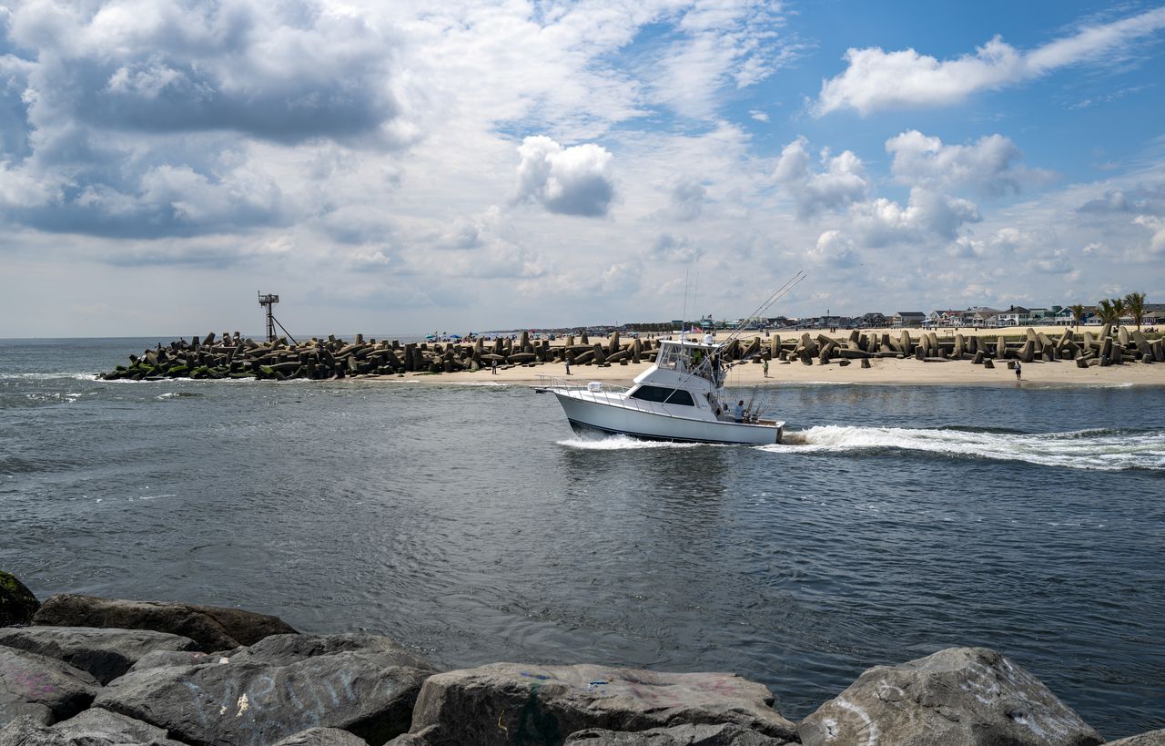
Andrew Mills | NJ Advance Media for NJ.com
The Army Corps of Engineers will visit the Manasquan Inlet next week to survey a large sandbar that has formed in the waterway, U.S. Rep. Chris Smith, R-4th Dist., said Wednesday.
Sands at the inlet have shifted before, but the low-tide sandbar is larger than anything seen there before, the congressman said.
"We are gravely concerned that it will pose a serious hazard to navigation," Smith said.
More: Manasquan Inlet Filling In ...
I finished the Dives Sites section of the website, the biggest and most complex part. I also finished the central 'hub' of the site and made some inroads in the Artificial Reefs and Biology sections. I'm also fixing things as I go, like broken weather forecasts.
And none too soon - the old site has become rather balky since I stopped paying attention to it several years ago. For one thing, it will not run on the latest version of PHP. Rather than figure that out, I'll put my efforts into this. It just took five minutes to load a page.
I also added Google Earth integration, which will let you zoom in on land-based sites. Not much point in setting it up at sea though, my 20-year-old wreck charts are still better than anything.
This site is now running on WordPress, with everything stored in a database. That gives a lot of flexibility. I don't really care for WordPress sites, they're usually ugly slabs with no structure. But I've buried WordPress so deep in here that you can't even tell it is there.
More: More Progress ...
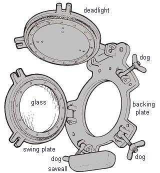
Portholes are used to let light and air into a ship. They are usually constructed of brass for corrosion resistance, which makes them highly desirable as collector's items. The drawing at right shows all the major parts:
- The immovable backing plate, bolted to the vessel's hull, which carries the hinges for the swing plate and deadlight
- The glass swing plate, which is secured shut by large butterfly nuts called 'dogs'
- The deadlight, used when it is desired to black-out the vessel, as in time of war
More: Portholes & Deck Lights ...