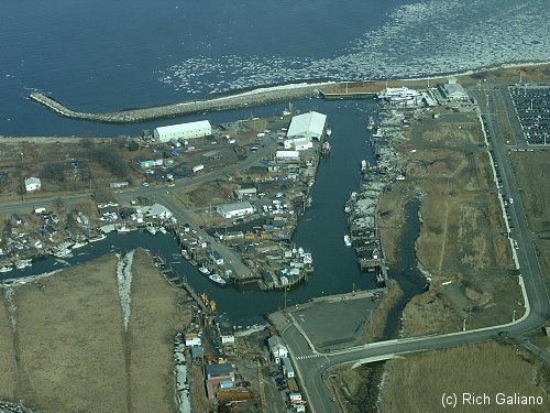
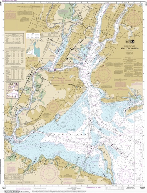
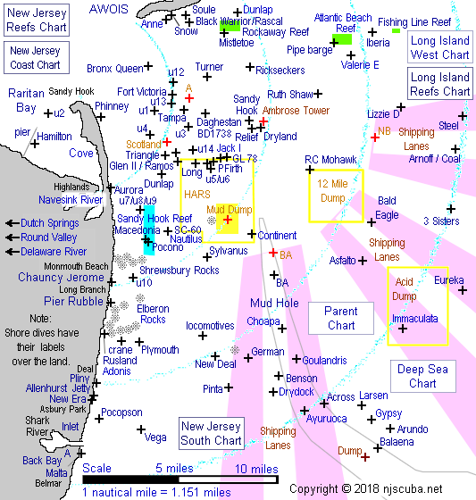
Raritan Bay
This bay is muddy and turbid, although some folks dive the several small wrecks around the inside of Sandy Hook. Bottle hunting around the old piers and pilings in Keyport harbor is also a possibility, but most of the structures along the bay shore are too small and shallow to be of interest. I have scouted the shoreline from Atlantic Highlands to Laurence Harbor, and nothing looks too promising. See also entries on Navesink River and Horseshoe Cove.

I have dived Sandy Hook bay on several occasions. The best viz I have seen was almost two feet. None of the dives were "for fun" - all were in shallow water just off the beach ( one under ice ) doing repair work for the marine labs. This would otherwise not be my top choice in dive spots.
Belford, wintertime, with ice on the bay and most of the fleet out. Unfortunately, the waters around the jetty are much too shallow for diving.
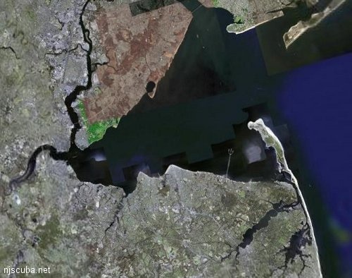
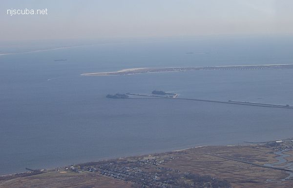
Of some interest is the huge Navy munitions pier associated with Naval Weapons Station Earle, and the large Navy fleet re-supply ships that home-port there.
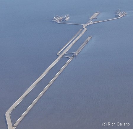
The Navy pier is almost 3 miles long. Too bad you can't dive here! You can see where the pier was rebuilt and extended.

Seen from space. The first time you go near here, you get a warning. The second time, they take your boat away. That's all.
USS Solar
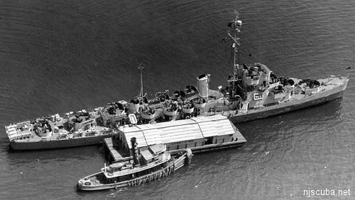
On April 30 1946 the destroyer escort USS Solar ( DE-221 ) exploded at the ammunition pier while unloading munitions. Seven sailors were killed, and 30 dock workers were injured. It is often erroneously reported that there were over 100 casualties.
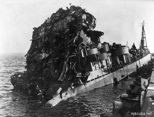
The forward half of the little ship was peeled open like a sardine can by the blast. Her hulk was towed 100 miles out to sea and scuttled in 700 fathoms of water on June 9 1946. The accident is attributed to the detonation of dropped Mousetrap ASW weapon during unloading, which is also thought to be the cause of the loss of the USS Turner.
On the morning of 4/30/46 I departed the USS Solar DE-221 approximately 1 hour prior to the explosions. I had visited with my x-team of ammo handlers (approximately 12) detailed to unload the ships ammo. I returned to my ship (YF-854) approximately 100 yards away, moored bow to stern with an LST in between. I never saw any of my x-teammates again. One of the 3 explosions was a boxcar they were loading with "hedge hogs", who's overhead landed about a half a mile or so on the adjacent parallel pier. The pier along side the ship where the unloading took place had a half moon crater thru about 5' of concrete. I seriously question that the fatalities were only 7 men of the ships crew. Thank you ... your website does bring back memories.
Signed R.J. Whitsitt, then S/2C 784-09-83

Questions or Inquiries?
Just want to say Hello? Sign the .