Navesink River
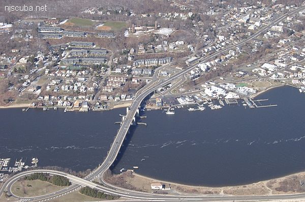
- Type:
- tidal river / inlet
- Depth:
- 30 ft max
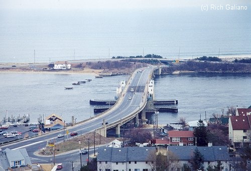
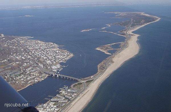
Above: picture taken from high up in the north tower at Twin Lights. The dive area is at the base of the bridge, beyond the red roof. The turn-off from Rt. 36 is visible at the lower left; Sandy Hook in the background. On a good day, the view from up here is really terrific, and the lighthouse itself houses an interesting little museum of shipwrecks, lighthouses, and nautical things. Note the strong currents swirling around the piers of the old bridge and in the boat channel. This is not a place for beginners!
Enter the water from the little beach right across from the Careless Navigator restaurant. The water is normally murky but you can almost always rely on 4 ft of viz on the bottom. The currents are very strong under the bridge and we bring a line in with us that we normally tie off somewhere so we can pull ourselves safely back out if necessary ( which we have needed to do on many occasions. )
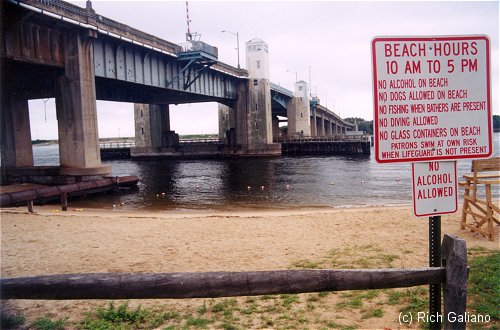
Not sure what to make of this sign. I think it means no diving in the swimming area. A nearby sign says no scuba diving in the swimming area.
There are a lot of bottles all over the area, and some pretty old ones. I recovered a round bottom from the 1800s in perfect condition and a Gulden's Mustard jar from the early 1900s on my last dive. Anything from beer bottles to soda bottles to milk bottles, perfume bottles, etc. Apart from bottles, there is a lot of odd junk that was probably dumped or thrown off the bridge over the years, and abundant plant life, but little in the way of fish or lobsters is evident.
Depths are about 30 ft by the first bridge support piling, pretty shallow behind the houses that are on the water ( 10-12 ft. ) Boat traffic can be heavy during the summer months, but all but the smallest boats keep to the channel. Since smaller boats will stray into the shallows, a flag is essential for safety as well as lawful requirements. Slack tide can run very short sometimes which can cut a dive short. All in all, though, it's a pretty good dive and one of my favorites.
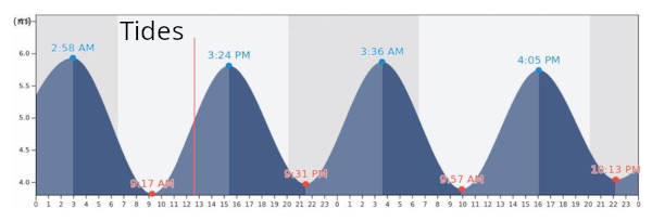
Since this is a tidal river, you must dive at slack water. If you've never dived a local river or inlet before, you may want to look at the page on Local Diving Conditions.
This information courtesy of Ted Wittke - Point Pleasant First Aid & Emergency Squad Dive Team

Questions or Inquiries?
Just want to say Hello? Sign the .