Early New Jersey Artificial Reefs
These seven sites on the Sea Girt Artificial Reef predate the state-run reef program:
Sea Girt Artificial Reef
- Boy Scout Reef
- car float
- Carlson II
- Cinderella
- Cranford
- drydock
- DVD Barge
- Dykes
- Captain Etzel
- Fisherman Barge
- Golden Eagle
- Horseshoe Wrecks
- Kiley B
- Lewis F Boyer (Travis)
- Liberty Barge 1
- Liberty Barge 2
- Liberty Barge 3
- Liberty Barge 4
- Marion
- Matt Turecamo
- Morania 180
- OWD IV
- PATH subway cars
- Railroad barge
- Response
- Restorer
- Rockland County
- Ronde Joyce
- Smoke II
- Spartan
- Swenson I
- Swenson II
- army tanks
- Wedding Barge
Informal reef-building took place all along the coast for decades, but these are the only sites for which records exist.
- Type:
- artificial reef, trawler
- Specs:
- ( 70 ft )
- Sponsor:
- Axel Carlson Jr.
- Sunk:
- June 1973 - Sea Girt Artificial Reef
- GPS:
- 40°06.805' -73°57.176'
- Depth:
- 70 ft
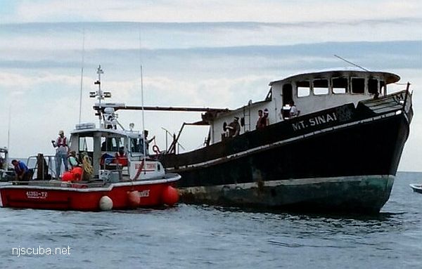
More: Carlson II ...
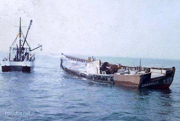
- Type:
- artificial reef, trawler
- Built:
- 1964, DESCO Marine, St. Augustine FL ?
- Specs:
- ( 70 ft )
- Sunk:
- Tuesday March 15, 1983 - Sea Girt Artificial Reef
- Sponsor:
- Artificial Reef Committee
- GPS:
- 40°06.777' -73°56.860'
More: Cinderella ...
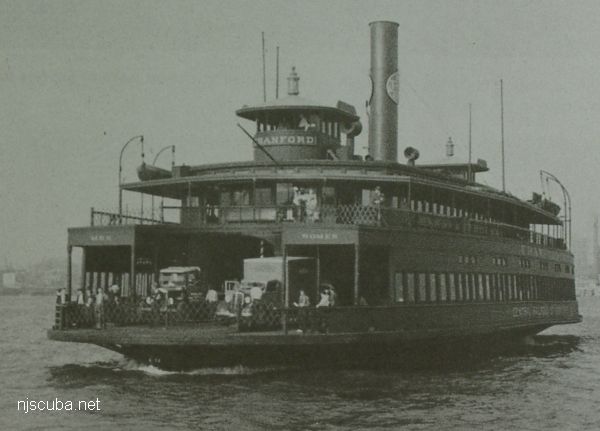
- Type:
- artificial reef, ferry, Central Railroad of New Jersey, USA
( sometimes incorrectly identified as a barge ) - Name:
- All CRRNJ ferries were named for New Jersey towns - Lakewood, Bound Brook, Red Bank, Plainfield, Elizabeth, Wilkes Barre, Cranford, Somerville, Westfield, and Bound Brook
- Built:
- 1905, Harlan & Hollingsworth, Wilmington DE USA
- Specs:
- ( 191 x 44 ft ) 1197 tons
- Sponsor:
- Ashley Development Corporation
- Sunk:
- Tuesday March 30, 1982 - Sea Girt Artificial Reef
- GPS:
- 40°07.447' -73°56.227'
- Depth:
- 70 ft
More: Cranford ...
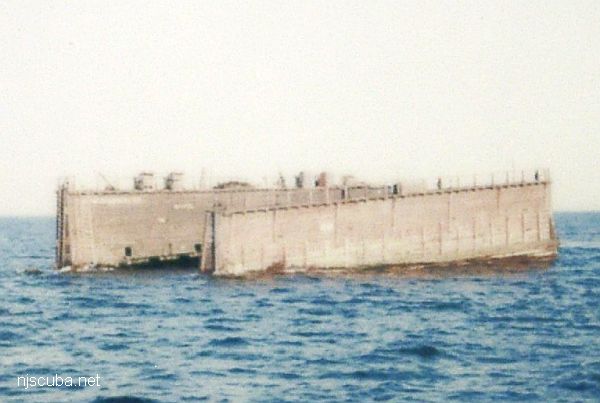
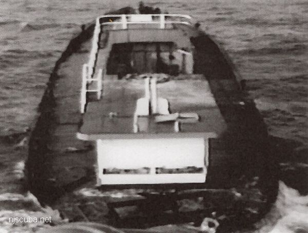
- Type:
- artificial reef, drydock barge
- Specs:
- ( 100 ft )
- Sunk:
- February 1979 - Sea Girt Artificial Reef
- Sponsor:
- Artificial Reef Committee
- Depth:
- 75 ft
- GPS:
- 40°07.759' -73°56.384'
More: drydock ...
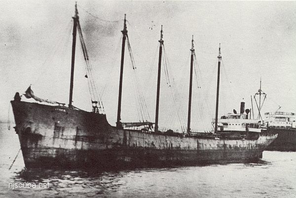
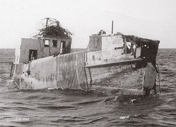
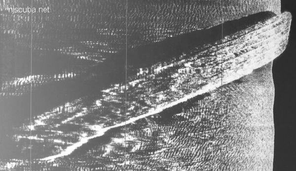
- Type:
- artificial reef, schooner barge, USA
( The small smokestack in the pictures is for an electrical generator. ) - Built:
- 1919, Union Shipbuilding, Baltimore MD USA
- Specs:
- ( 306 x 35 ft ) 2072 tons, 14 crew
- Sponsor:
- Modern Transportation Co.
- Sunk:
- July 1983 - Sea Girt Artificial Reef
- GPS:
- 40°06.964' -73°57.571'
- Depth:
- 65 ft
More: Dykes ...
- Type:
- artificial reef, trawler
- Specs:
- ( 75 ft )
- Sunk:
- June 1983 - Sea Girt Artificial Reef
- Sponsor:
- Artificial Reef Committee
- GPS:
- 40°06.540' -73°56.827'
- Depth:
- 70 ft
More: Kiley B ...
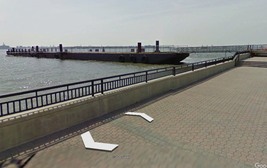
- Type:
- artificial reef, car float barge, USA
- Specs:
- ( 330 x 40 ft ) cut into pieces
- Sponsor:
- NJDOT / NJDEP
- Sunk:
- Nov 2025 - Sea Girt Artificial Reef
- GPS:
- 40°07.793' -73°56.824'
40°07.832' -73°56.546'
40°07.859' -73°56.515'
40°07.952' -73°56.413' - Depth:
- 65 ft
The 330-foot car float barge Liberty was removed from the Hudson River in sections to clear space for a new ferry terminal at Liberty State Park. Formerly, Liberty was used at the park as a passenger-loading platform for ferries transiting to Ellis Island and the Statue of Liberty since 2005. It sank in a storm in 2020.
More: Liberty Barge ...
- Type:
- artificial reef, barge
- Specs:
- ( 200 ft )
- Sunk:
- 1977 - Sea Girt Artificial Reef
- Sponsor:
- Artificial Reef Committee, Weeks Marine Co.
- GPS:
- 40°06.986' -73°56.868'
- Depth:
- 70 ft
More: railroad barge ...