
Shark River - Back Bay
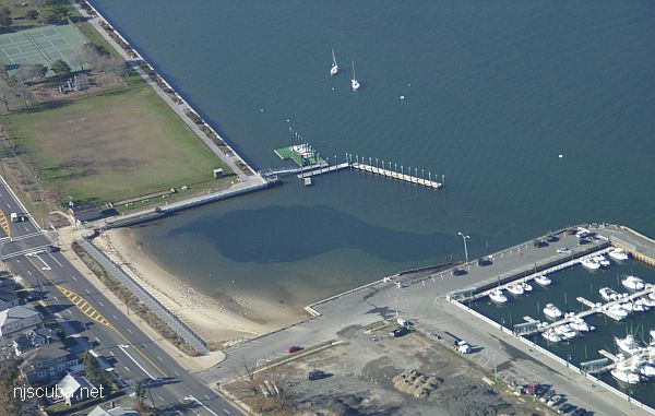
- Type:
- inland tidal bay
- Depth:
- 20 ft max, 15 ft in most places
This dive site, formerly known as 'L Street' has changed completely, and for the better. The town of Belmar has done something really nice for us divers and installed wide wooden steps down the bulkhead in Maclearie Park. This more than makes up for the loss of the boat ramp area, which is off-limits to all swimmers since it was rebuilt. I suppose the little cove by the ramp is still accessible from the beach, but the new site is much better, and far from all the dangerous boat traffic around the ramp and marina.
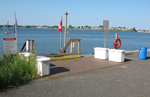
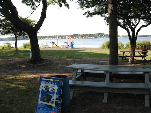
The new steps are just west of the tennis courts. There is ample parking, with a short walk to sturdy picnic tables under shady trees that you can use to gear up. There are barbecue grills, trash cans, a boardwalk and playground, and restrooms and showers not far off, although these are not guaranteed to be open. So you can make a nice outing of it, with non-divers even. At the steps are 4 dock lockers that you can put your own padlock on. The dock flies dive flags, and at night it has a blinking yellow light. The only downside is that it is a rather long swim if you want to go inspect the pilings around the sailboat and fishing docks.
Shark River Back Bay
The red mark indicates the approximate location of the new steps. For scale, the length of a tennis court with overruns ( fence-to-fence ) is 40 yards. The docks and cove are at the extreme right, approximately 275 yards to the east. The total length of the bulkhead corner-to-corner is approximately 450 yards. Traffic in the parking lot is one-way, west to east. The remainder of this description is from the old days when you dove around the boat ramp, but everything basically still applies:
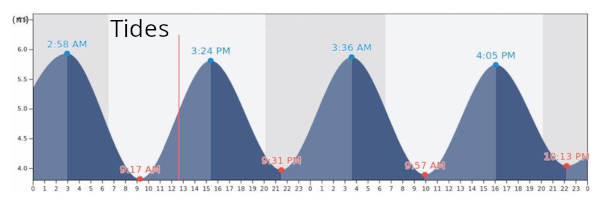
The back bay at Shark River is a fine shallow dive, and a good way to salvage a day when the weather prevents diving in the inlet or the ocean. The bottom here is silty mud and easily stirred up. For this reason, it is best to miss the tide slightly rather than dive right on it. This way there will be a gentle current to carry away whatever mess you make. When the tide does start to run, the water just slowly ebbs away, unlike the Railroad Bridge, where things can get crazy and even dangerous pretty fast if your timing is off.
One thing to watch for when diving this site is the wind. A north or west wind will quickly fill this shoreline with all the seaweed and garbage in the bay. This makes for poor visibility and a nasty disgusting mess during entry and exit. A south or east wind will do the opposite, and blow all the junk to the far side of the bay. Coincidentally, an east wind is most likely to cause your boat trip to be canceled, which makes the Shark River bay the perfect backup dive plan. However, if the wind has been blowing from the wrong direction for several days, then this site is best avoided; try the inlet or the Railroad Bridge instead, where the current will scour away any accumulated mess.
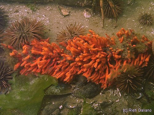
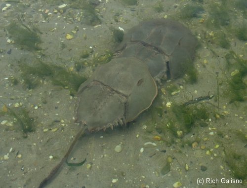
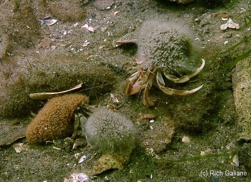
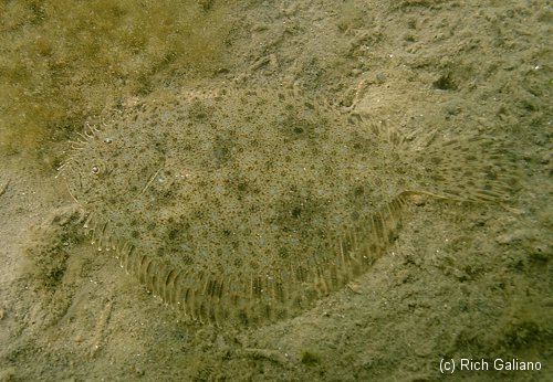
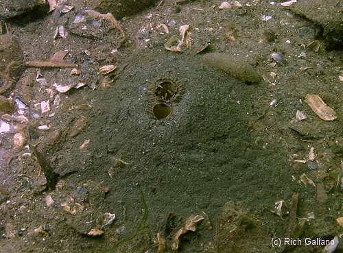
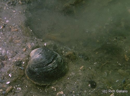
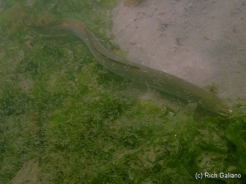
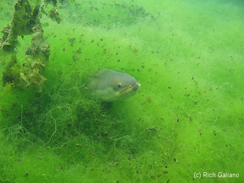
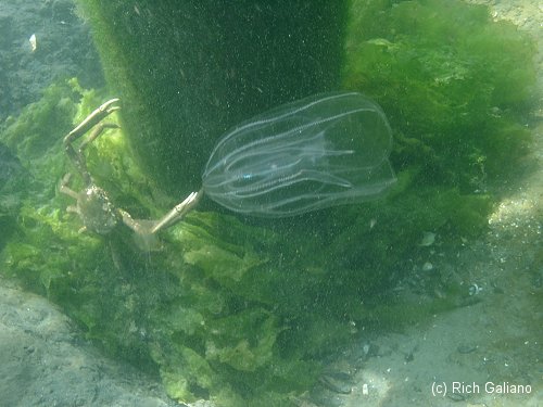
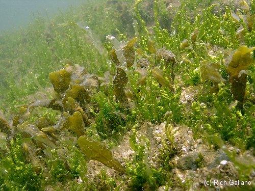
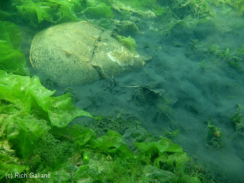
Much of this area is only five feet deep, going down to about 14 feet at high tide. This makes for a great deal of ambient light during the day, and there are no time exclusions here as there are at the inlet. Together with sometimes startlingly clear water, this makes for a good spot to play with a camera, even one of those little waterproof disposable pool cameras. You will find plenty to photograph. Later in the season, what wood remains is overgrown with many colors of sponge, anemones, and algae - red, pink, orange, purple, green, brown. Flounders from tiny one-inch babies up to doormats, prehistoric Horseshoe Crabs, and many other crabs, urchins, starfish, mussels, clams, jellyfishes, baitfish, baby cunners, and Sea Bass, Butterflyfishes ( in season ) and eels are all to be found here.
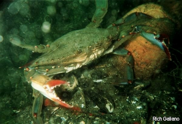
Expect visibility in the 10 ft range, with negligible current and wave action. Boat traffic may be a problem, so be sure to have a flag. Many of these boaters are renters from the marina next door, and the worst sort of idiots who will drive right up to your flag just to see what it is, so if you do hear an outboard whirring overhead, stick below it on the bottom until it goes away. Also, try to stay away from the fishermen by the boat ramp.
My sole experience night-diving this site was a disappointment, although a rather unique one: A blizzard of tiny shrimp-like swimming crustaceans, attracted to my dive light, formed my own personal white-out whenever I stopped moving, quickly reducing the viz to near zero. Not really dangerous, but nearly impossible to get anything done.
There are no time restrictions for diving at this site that I am aware of. Since this is a tidal river, you should dive at slack water. Also, given the shallowness, a high tide is essential. If you've never dived a local river or inlet before, you may want to look at the page on Local Diving Conditions. This site is used regularly for training dives and classes by the local dive shops.
Dive Sites, Manasquan Dive Sites, New Jersey Dive Sites, Sandy Hook Dive Sites,
Manasquan Chart
- Barge #10
- 120 Wreck
- 3 Sisters
- Ambrose Buoy
- A Street - Shark River
- Across
- Adele
- Ajace
- Alex Mac
- Allenhurst Jetty
- Anastasia
- Antioch
- Arnoff
- Arundo
- Asfalto
- Aurora
- Ayuruoca
- BA Wreck
- Shark River - Back Bay
- Balaena
- Bald Eagle
- Barnegat Inlet
- BD1738
- USS Benson
- Beth Dee Bob
- Blue Boy
- Bonanza
- Brick barge
- Bronx Queen
- Brunette
- Cecilia M Dunlap
- Cornelius Grinnell
- Catherine Jackson
- Chauncy Jerome
- Caddo
- Cadet
- Capt Smitty
- Catamount
- Charlemagne Tower
- Chaparra
- Chesapeake
- Choapa
- clam boat
- Continent
- crane barge
- Creole
- Daghestan
- Delaware
- drydock
- Dryland
- dump
- Duncan
- Edmund Phinney
- Elberon Rocks
- Emerald / USS Hibiscus
- Eureka
- Francis A Perkins
- William R Farrell
- FF Clain
- Finance
- Fort Victoria
- Gassoon
- German
- Lady Gertrude
- GL78
- Glen II
- Glory Wreck
- I.P. Goulandris
- Granite Wreck
- Great Isaac
- Gulftrade (stern)
- Gulftrade (bow)
- Gypsy
- Horseshoe Cove
- Alexander Hamilton
- Hankins (Big)
- Hankins (Offshore)
- Hankins 3
- Happy Days
- Cornelius Hargraves
- Harry Rush
- Harvey's Schooner
- Thomas Hebert
- Ida K
- Immaculata
- Inshore barge/tug
- Irene/Truro
- Irma C
- John Minturn
- Jack I
- Joan La Rie III
- Klondike Rocks
- Lizzie H. Brayton
- Lana Carol
- Larsen
- Lavallette Wreck
- Leon Walter
- Lillian
- Lizzie D
- Long Branch locomotives
- Logwood
- H.W. Long
- Macedonia
- Mahogany
- Malta
- Manasquan Inlet
- Marion
- Maurice Tracy
- Mediator
- Meta
- Middle Barge
- Mistletoe
- R.C. Mohawk
- Mohawk
- Manasquan Wreck
- Nautilus
- Navesink River
- Northeast Sailor
- New Reef
- New Deal
- New Era
- NW Barges
- Olsen
- HMS Pentland Firth
- Park City
- Peerless
- Persephone
- Long Branch Pier Rubble
- Pinta
- Pliny
- Plymouth
- Pocopson
- Remedios Pascual
- Ruth Shaw
- Ramos
- Ranger
- Reliable
- Relief Lightship
- Rickseckers
- Ridge Schooner
- Riggy
- Rjukan
- Rockaway Belle
- Roy's barge
- RP Resor
- Manasquan River Railroad Bridge
- Rudder Wreck - Pocono
- Rump
- Rusland / Adonis
- Scotland Buoy
- San Saba
- Sandy Hook Pilot Boat
- SC-60
- Sea Girt Inlet
- Sea Girt Wreck
- Sea Hag
- Seaside Crane Barge
- Shark River Inlet
- Shrewsbury Rocks
- Simala
- Spring Lake Sailor
- Steel Wreck
- Stolt Dagali
- Sumner
- Southwest Mohawk
- Sylvanus
- Tampa III
- Thurmond
- Tolten
- Train Wheel
- Troop Carrier
- USS Turner
- AWOIS 8087
- AWOIS 8097
- u11
- AWOIS 7509
- AWOIS 7932
- AWOIS 9768
- AWOIS 12966/11422
- AWOIS 1609
- AWOIS 8084
- AWOIS 7940
- AWOIS 7938
- AWOIS 8076
- AWOIS 4600
- AWOIS 8075
- Valerie E
- Vega
- Vivian
- Vizcaya
- Warrior
- Western World
- Edward W Winslow
- Yankee (G+D)
- Yellow Flag
- ZPG-3W
More: Manasquan Dive Sites Chart ...
- Type:
- smallish tidal river inlet with stone jetties or bulkheads on both sides
- Depth:
- 15 ft
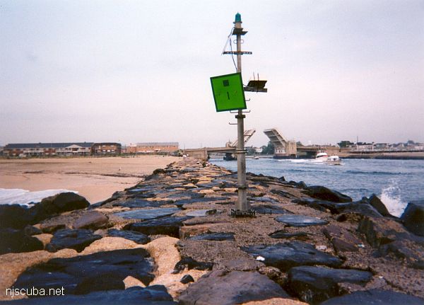
The Shark River is your best bet for shore diving in the northern half of the New Jersey coastline, far better than the Manasquan River. Shark River offers at least four different locations to dive: either side of the inlet, with rock jetties to explore, slightly upstream at A Street in Belmar, and upriver in the back bay area at L Street, Belmar. The wreck of the Malta is also just a few blocks south on the beach, but hardly worth diving.
More: Shark River ...
Shark River Inlet
- Type:
- smallish tidal river inlet with stone jetties or bulkheads on both sides
- Depth:
- 15 ft
This inlet has an L-shaped jetty on the north side and a longer straight jetty on the south side. Both jetties are made of loose stones - hardly any concrete - and the bottom is sandy and usually clean. You can walk over the bridge from one side of the inlet to the other in about five minutes.
More: Shark River Inlet ...
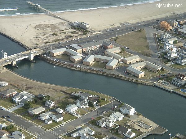
Yet another place to dive the Shark River is on the south side, near the intersection of 1st Avenue and A Street, behind the apartments. There is limited but very convenient free parking. A small cement stairway leads down to a concrete ledge above the water. Climb down between the big rock and the bulkhead, where you will find more steps underwater. ( Whoever B.M and M.M. are - thank you! )
More: Shark River - A Street ...
Sandy Hook / Rockaway Inlet Chart
- Barge #10
- 120 Wreck
- 3 Sisters
- Ambrose Buoy
- A Street - Shark River
- Acara
- Across
- Adele
- Ajace
- Alex Mac
- Allenhurst Jetty
- Antioch
- Arnoff
- Arundo
- Asfalto
- Aurora
- Ayuruoca
- BA Wreck
- Shark River - Back Bay
- Balaena
- Bald Eagle
- BD1738
- USS Benson
- Beth Dee Bob
- Blue Boy
- Bronx Queen
- Bug Light
- Charles Dunlap
- Cecilia M Dunlap
- Catherine Jackson
- Chauncy Jerome
- Cornelia Soule
- Choapa
- coal (Lido)
- Continent
- crane barge
- Daghestan
- Dragger
- drydock
- Dryland
- Edwin Duke / Stone Barge
- dump
- Dutch Springs
- Edmund Phinney
- East Rockaway Inlet
- Ed's Schooner
- Elberon Rocks
- Eureka
- Finance
- Fort Victoria
- German
- GL78
- Glen II
- I.P. Goulandris
- Gypsy
- Horseshoe Cove
- Alexander Hamilton
- Howard
- Iberia
- Immaculata
- Inshore Schooner
- Jack I
- Joan La Rie III
- Jones Inlet
- Jones Tug
- Klondike Rocks
- Larsen
- Lizzie D
- Long Branch locomotives
- Logwood
- H.W. Long
- Macedonia
- Mahogany
- Malta
- Manasquan Inlet
- Margaret
- Marion
- Mistletoe
- R.C. Mohawk
- Manasquan Wreck
- Nautilus
- Navesink River
- Northeast Sailor
- New Reef
- New Deal
- New Era
- HMS Pentland Firth
- Long Branch Pier Rubble
- Pinta
- Pipe Barge
- Pliny
- Plymouth
- Pocopson
- Princess Anne
- Ruth Shaw
- Robert A Snow
- Ramos
- Ranger
- Relief Lightship
- Rickseckers
- Rjukan
- Rockaway Inlet
- Rockaway Belle
- Round Valley
- Roy's barge
- Rudder Wreck - Pocono
- Rusland / Adonis
- Scotland Buoy
- Sandy Hook Pilot Boat
- SC-60
- Sea Girt Inlet
- Sea Girt Wreck
- Shark River Inlet
- Shrewsbury Rocks
- Spring Lake Sailor
- Steel Wreck
- Stolt Dagali
- Sylvanus
- Tampa III
- USS Turner
- AWOIS 8087
- AWOIS 8097
- u11
- AWOIS 7509
- AWOIS 7932
- AWOIS 9768
- AWOIS 12966/11422
- AWOIS 1609
- AWOIS 8084
- AWOIS 7940
- AWOIS 7938
- AWOIS 8076
- AWOIS 4600
- AWOIS 8075
- Valerie E
- Vega
- Warrior
- Delaware River Water Gap
- Western World
- Edward W Winslow
More: Sandy Hook Dive Sites Chart ...
Questions or Inquiries?
Just want to say Hello? Sign the .