Side-scan Sonar (1/3)
Side-scan sonar is a modern method of underwater imaging that can produce remarkably detailed and realistic views of shipwrecks and other bottom features using sound rather than light.
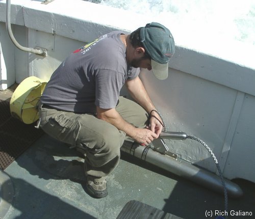
The torpedo-like sonar tow "fish", which is towed in the water behind the boat. The speed of the boat and the length of the tow cable determine the depth of the fish.
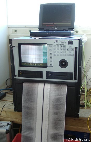
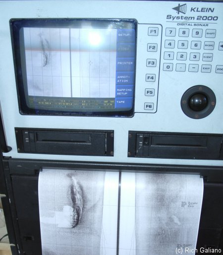
Above is a side-scan data recorder which generates a paper trace of the scan, as well as writing the data to tape. More modern units are entirely PC-based. On the paper or the screen, the black centerline is the towfish itself, or rather the area directly below it.
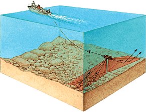
which it cannot see. The white area on either side of the center is an area that the fish cannot see very well, although tall objects may appear. The gray area outside of that is the bottom, along with whatever objects are there ( in this case, nothing interesting. ) Note that the sonar fish scans to both sides at once.
The laptop on top of the side-scan recorder is connected to a GPS. The blip on the screen is actually the boat, displayed with its course and speed. For a good scan, it is necessary to drive a very straight and precise course.
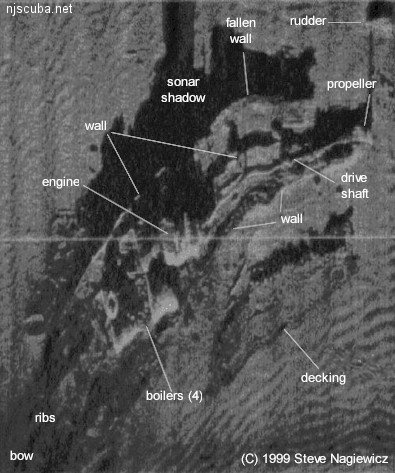
Normally, the side-scan device produces images where shadows are lighter and reflections are darker. This is confusing to the eye for most people, so I usually reverse it to get a much more natural-appearing image. Most of the side-scan images in this website ( including this one ) are actually negatives.
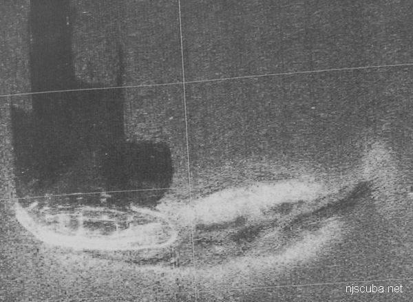
To get accurate images, the towing vessel must steer a precisely straight line at a constant speed. As anyone who has ever driven a boat can tell you, this is not always easy. Course deviations result in bent images, while speed deviations stretch out or compress parts of the image along the direction of travel ( usually the horizontal axis in the image. ) the side-scan of the Delaware at the top of this page showcases both effects - despite appearances, the wreck is actually perfectly straight, as was the vessel when it sank.

Most of the side-scan sonar images in this website are courtesy of Enviroscan Inc, Lancaster PA / Vince Capone and/or the Artificial Reef Program.