Shoreham

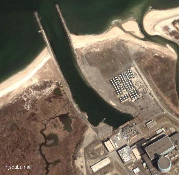
Now, most people would look at the heading on the page and think that I was crazy for diving near a nuclear power plant. Just to calm your fears, this power plant was never brought online, so there is no chance of getting radiated at this location (barring a nuclear war while you're diving). With that said, Shoreham can be a very interesting dive. Located on the north shore of Long Island (I don't know the name of the town, look on a map), it is a shallow dive with an average depth of around 16 ft. Visibility tends to be anywhere from 3 to 10 ft.
There are several points of interest at this location. First, there are two long jetties to explore. I have spent entire dives just exploring the east jetty inside and out. The jetties form the water inflow that was supposed to be used to cool the reactors so be careful about swimming too far in or you will end up with security guards pulling you out of the water. This is usually not a problem, however, because the water is very shallow as you approach the power plant (around 3 ft).
Second, the plant also has an outflow pipe (to get rid of the hot water). This can be a little harder to find since it is not visible from the shore. There are several tell-tale signs for finding it however, either look for the fishing boats, which like to line up above the outflow pipe, or jump in the water and look for a strange carpet of green grass heading straight north. It's pretty easy to find since no grass grows on either side of it. Occasionally, you can find a bug (lobster) or two hiding under one of the rocks used to hold the buried outflow pipe in place.
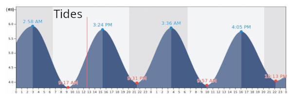
Getting to the east jetty and outflow pipe is a little tricky. First, after parking your car, you will see a small stream which has to be crossed before you can hit the water. Don't let this stream fool you, however, when the tide is changing the current can easily pull you out to sea. In fact, I heard of one diver that was swept out over 600 yards. I don't say this to frighten you. I just figure you should be informed. The correct way to cross the stream is to walk all the way to the end (the north end) when the tide is coming in and cross. This way if you get caught in the current you will be pushed inland. On the return trip (assuming the tide has changed) walk down the beach until you are just south of the boat ramp and cross. If you are in the right spot you should have to swim very little to get to the boat ramp. The current coming around the corner will push you in the right direction. After you traverse the stream, you still are faced with the walk down the beach. This all might sound a little safari-like, but you should have an enjoyable dive once you hit the water.
You can get to the west jetty by several means. The first and probably best way is to own a four-wheel-drive vehicle and drive down the beach until you get to the jetty. Of course, we can't all own a Range Rover, so for those of us that own a two-wheel drive vehicle, I suggest either swimming across the inlet from the east jetty or getting a boat.
-- Roger T. Mailler


Questions or Inquiries?
Just want to say Hello? Sign the .