Granite Wreck

- Type:
- shipwreck, sailing ship
- Specs:
- ( 200 ft at least )
- Depth:
- 115 ft

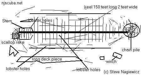
The Granite Wreck is the remains of a big, anonymous old wooden sailing ship. The interesting thing about it is that it is scarcely sanded-in, so a great deal of the structure is visible. The huge stone blocks for which the site is named lie in rows atop the ribs. Across a short sandy gap on either side, the fallen walls of the hull are themselves alone bigger than most wooden wrecks of this type. The bow is marked by a chain pile and a small broken-down donkey boiler and winch, while amidships a mast lies diagonally across the top of the wreck. The aft end of the keel is marked by an old scallop dredge, lost by a dragger who got in a little too close.
All along all the edges of the wreckage are deep holes, formed by the inner and outer hull planking and the ribs. These make ideal homes for lobsters, although they are not necessarily ideal for divers, as most are quite deep and the lobsters can easily escape. Lobsters also live under the stones, where they are easier to catch.
On a clear day, this is a spectacular deep dive, with or without lobsters. Swimming high over the wreck, the well-defined ribs, and keel look like the skeleton of some gigantic prehistoric creature, and you can really get a sense of the structure of the vessel. This wreck also yields an artifact now and then. This wreck even has a soundtrack - the strumming propellers of passing freighters in the shipping lanes above.
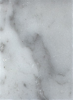
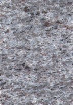
 Marble - smooth |  Granite - grainy |
The stone blocks on the Granite wreck are far too large to be ballast and are almost certainly cargo. Small samples of the stone proved to be riddled with marine boring organisms, and seem to be calcareous in nature, as would be expected if they were marble. Borers would make no headway at all in quartz-like granite, so perhaps this wreck is misnamed!


Questions or Inquiries?
Just want to say Hello? Sign the .